Latitude: 52.4645 / 52°27'52"N
Longitude: -1.9072 / 1°54'25"W
OS Eastings: 406402
OS Northings: 285182
OS Grid: SP064851
Mapcode National: GBR 5YG.SD
Mapcode Global: VH9Z2.WBM0
Plus Code: 9C4WF37V+R4
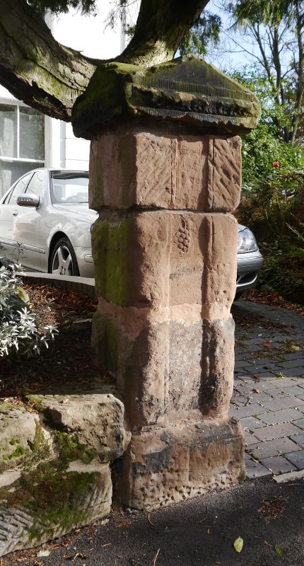
Entry Name: Front Walls and Two Pairs of Gate Piers to Numbers 55 and 56
Listing Date: 8 July 1982
Grade: II
Source: Historic England
Source ID: 1343356
English Heritage Legacy ID: 216899
ID on this website: 101343356
Location: Lee Bank, Birmingham, West Midlands, B15
County: Birmingham
Parish: Non Civil Parish
Built-Up Area: Birmingham
Traditional County: Warwickshire
Lieutenancy Area (Ceremonial County): West Midlands
Church of England Parish: Birmingham St Luke
Church of England Diocese: Birmingham
Tagged with: Wall
CHARLOTTE ROAD 1. 5104 Edgbaston B3 Front walls and two pairs of gate piers to Nos 55 and 56 SP 0685 SW 46/12 II GV 2. Cl830-40, two surviving pairs of red sandstone gate piers, panelled with vermiculated surrounds; pediment caps. Linked by dwarf sandstone walls.
Listing NGR: SP0640285182
External links are from the relevant listing authority and, where applicable, Wikidata. Wikidata IDs may be related buildings as well as this specific building. If you want to add or update a link, you will need to do so by editing the Wikidata entry.


Other nearby listed buildings