Latitude: 53.4507 / 53°27'2"N
Longitude: -3.0001 / 3°0'0"W
OS Eastings: 333681
OS Northings: 395346
OS Grid: SJ336953
Mapcode National: GBR 715.AB
Mapcode Global: WH870.WJKH
Plus Code: 9C5RFX2X+7X
Entry Name: Former Fire Station
Listing Date: 24 August 1985
Grade: II
Source: Historic England
Source ID: 1343260
English Heritage Legacy ID: 216425
ID on this website: 101343260
Location: Bootle, Sefton, Merseyside, L20
County: Sefton
Electoral Ward/Division: Linacre
Parish: Non Civil Parish
Built-Up Area: Bootle
Traditional County: Lancashire
Lieutenancy Area (Ceremonial County): Merseyside
Church of England Parish: Bootle St Matthew with St Mary
Church of England Diocese: Liverpool
Tagged with: Fire station
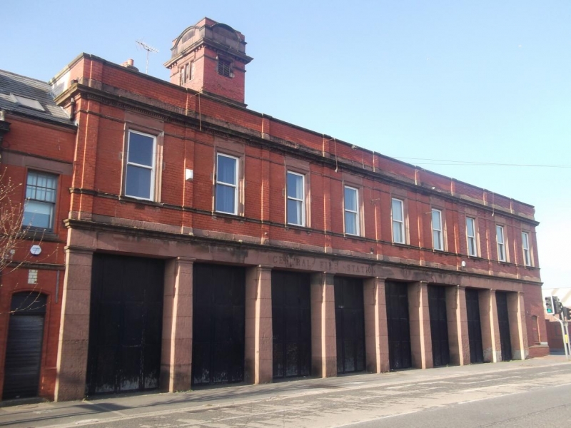
BOOTLE STRAND ROAD SJ 39 NW (north side) 9/27 Former fire station 24.8.85 II Fire station, converted to restaurant. 1902. Brick with stone dressings now painted. 2 stories, 9 bays with domestic-type block to left of 2 storeys with attic and 3 bays; tower to rear. Ground floor cornice, 1st floor sill course and top frieze, cornice and parapet. 1st floor windows have architraves and friezes and most are sashed with glazing bars. Ground floor has 8 large entrances with folding doors between Doric antae; a small blocked window to end bay. Domestic-type block has 1st bay breaking forward under gable with top segmental pediment. Ground floor paired segmental-headed windows, sashed with glazing bars; entrance to right 1st floor paired windows to 1st bay have 2-light attic window; flat-topped dormer to right. 2 banded stacks. Tower top stage has 3-light windows cornice and parapet with segmental-headed panels.
Listing NGR: SJ3368195346
External links are from the relevant listing authority and, where applicable, Wikidata. Wikidata IDs may be related buildings as well as this specific building. If you want to add or update a link, you will need to do so by editing the Wikidata entry.


Other nearby listed buildings