Latitude: 52.0549 / 52°3'17"N
Longitude: -1.8309 / 1°49'51"W
OS Eastings: 411688
OS Northings: 239628
OS Grid: SP116396
Mapcode National: GBR 3M1.5X5
Mapcode Global: VHB12.6MX1
Plus Code: 9C4W3539+XJ
Entry Name: The Old School House
Listing Date: 25 August 1960
Grade: II
Source: Historic England
Source ID: 1341769
English Heritage Legacy ID: 127029
ID on this website: 101341769
Location: Saintbury, Cotswold, Gloucestershire, WR12
County: Gloucestershire
District: Cotswold
Civil Parish: Saintbury
Traditional County: Gloucestershire
Lieutenancy Area (Ceremonial County): Gloucestershire
Church of England Parish: Willersey with Saintbury
Church of England Diocese: Gloucester
Tagged with: House
SP 1039-1139 SAINTBURY SAINTBURY
14/112 The Old School House 25.8.60
II
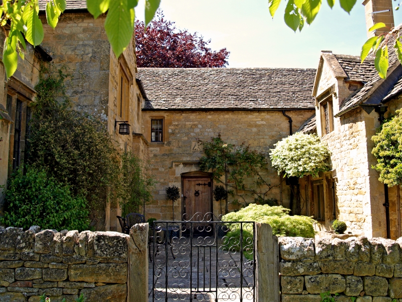
Former school room and school house, now house. C19 with C20 additions at rear. Coursed squared and dressed limestone with buttress on right of left wing. Limestone slate roof with flat coping to gables. 'U'-shaped plan with former school room projecting forward left and the school house projecting forward on the right. 2 storeys. Second storey lit by hipped, late C19/early C20 dormers and Cotswold dormers across eaves. 2-light windows with leaded panes. Others C19 flat-chamfered, stone mullioned casements of 1, 2 and 3-lights with stopped hoods over. Central front door with blind, 4-centred arch over and stopped hood. Unpainted plank door with decorative strap hinges and ring knocker.
Listing NGR: SP1168839628
External links are from the relevant listing authority and, where applicable, Wikidata. Wikidata IDs may be related buildings as well as this specific building. If you want to add or update a link, you will need to do so by editing the Wikidata entry.


Other nearby listed buildings