Latitude: 52.0739 / 52°4'25"N
Longitude: -1.7986 / 1°47'54"W
OS Eastings: 413899
OS Northings: 241740
OS Grid: SP138417
Mapcode National: GBR 4N1.VFW
Mapcode Global: VHB12.S40J
Plus Code: 9C4W36F2+GH
Entry Name: Glebe Farmhouse
Listing Date: 25 August 1960
Grade: II
Source: Historic England
Source ID: 1341751
English Heritage Legacy ID: 126928
ID on this website: 101341751
Location: Aston Subedge, Cotswold, Gloucestershire, GL55
County: Gloucestershire
District: Cotswold
Civil Parish: Aston Subedge
Traditional County: Gloucestershire
Lieutenancy Area (Ceremonial County): Gloucestershire
Church of England Parish: Weston-sub-Edge with Aston-sub-Edge
Church of England Diocese: Gloucester
Tagged with: Farmhouse
SP 14 SW ASTON SUBEDGE ASTON SUBEDGE VILLAGE
4/8 Glebe Farmhouse 25.8.60
II
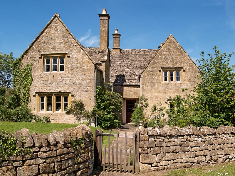
Farmhouse. Early/mid C17 left wing, and late C17 right wing. Squared and dressed limestone with limestone slate roof and flat limestone coping to gable ends with roll. Roll, cross saddles on left wing. 3 ashlar chimneys with moulded tops, one from a projecting stack from right wall of left gable, one at ridge in line with latter and one from eaves at rear. Twin gables to front, the left projecting further than the right with cross passage connecting the two elements. 2 storeys. 1:1 windowed. 3 and 4-light stone-mullioned windows. Partially glazed C20 front door set back within porch between the two gables. Scratch sundial below first floor window in left gable end, another over possible former entrance in left wall. Interior: room, rear left, has exposed beams and a large inglenook fireplace with two niches with pointed heads in its back wall. Room, at front, left has a large 4-centred arched stone fireplace with a smaller, late C17 flat, moulded lintel over. Ground floor only inspected.
Listing NGR: SP1389941740
External links are from the relevant listing authority and, where applicable, Wikidata. Wikidata IDs may be related buildings as well as this specific building. If you want to add or update a link, you will need to do so by editing the Wikidata entry.


Other nearby listed buildings