Latitude: 51.9033 / 51°54'11"N
Longitude: -1.6481 / 1°38'53"W
OS Eastings: 424309
OS Northings: 222812
OS Grid: SP243228
Mapcode National: GBR 5RP.Q4N
Mapcode Global: VHBZD.DF28
Plus Code: 9C3WW932+8Q
Entry Name: Banks Farm
Listing Date: 25 August 1960
Grade: II
Source: Historic England
Source ID: 1341090
English Heritage Legacy ID: 130176
ID on this website: 101341090
Location: Bledington, Cotswold, Gloucestershire, OX7
County: Gloucestershire
District: Cotswold
Civil Parish: Bledington
Built-Up Area: Bledington
Traditional County: Gloucestershire
Lieutenancy Area (Ceremonial County): Gloucestershire
Church of England Parish: Bledington St Leonard
Church of England Diocese: Gloucester
Tagged with: Agricultural structure
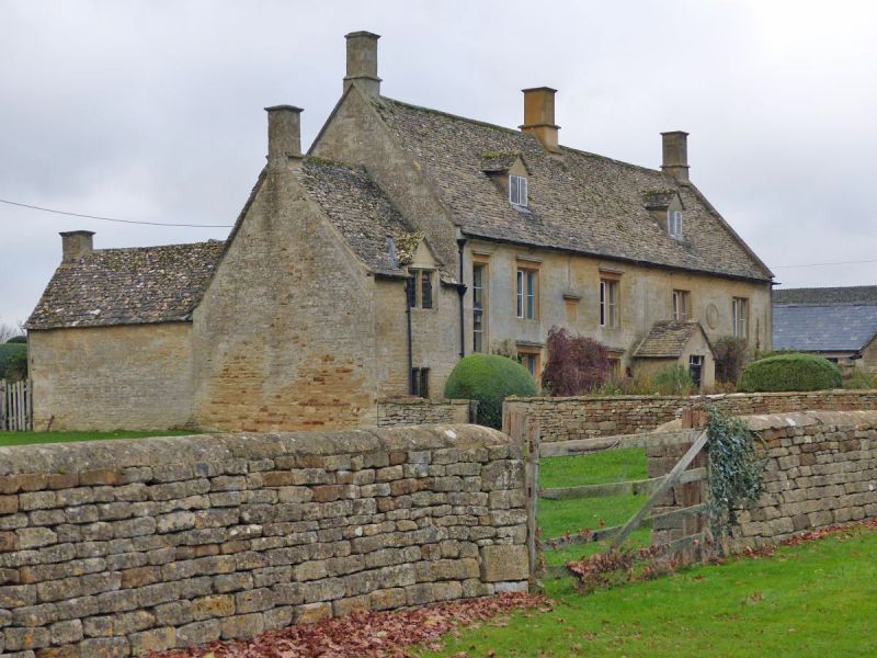
BLEDINGTON THE GREEN SP 2422 12/64 Banks Farm 25.8.60 GV II Detached farmhouse and attached buildings forming two sides of yard. Farmhouse; left end possibly C17, rectangular stone plaque set between upper windows on left dated and initialled E S/E S/1736 S circular stone plaque dated and initialled W A/1784 between upper windows on right, indicating two C18 phases of rebuilding/extension. Late C18-mid C19 outbuildings and attached barn. C17 core and extensions to rear coursed, squared and dressed limestone, C18 extensions, finely dressed limestone, stone slate roof, ashlar stacks. Slate roof to barn and outbuildings at rear. Rectangular main body with successive C18 extensions right of C17 core, projecting porch off centre right, C18 extension rear left, C19 extension forming one side of courtyard rear right. C17 core one storey and attic lit by single 2-light, stone-mullioned half dormer with leaded lights. C18 part 2 storeys and attic lit by two 2-light roof dormers with leaded panes. C18 extensions right, 4- windowed all tall double-chamfered, stone-mullioned windows with horizontal glazing bars, tall stair light far left, all windows to mid C18 part with moulded hoods. Moulded hoods over 1736 datestone and blocked door below also. Fielded 6-panel door into late C18- early C19 porch off centre right. C20 part-glazed door far right. C19 former wash house attached rear right with barn attached at right angles at far gable end, the latter buildings forming 2 sides of a yard. Interior not inspected.
Listing NGR: SP2430922812
External links are from the relevant listing authority and, where applicable, Wikidata. Wikidata IDs may be related buildings as well as this specific building. If you want to add or update a link, you will need to do so by editing the Wikidata entry.


Other nearby listed buildings