Latitude: 51.7824 / 51°46'56"N
Longitude: -1.878 / 1°52'40"W
OS Eastings: 408513
OS Northings: 209316
OS Grid: SP085093
Mapcode National: GBR 3Q9.615
Mapcode Global: VHB2D.DGJF
Plus Code: 9C3WQ4JC+XR
Entry Name: Lower Farmhouse
Listing Date: 23 January 1952
Grade: II
Source: Historic England
Source ID: 1340899
English Heritage Legacy ID: 131161
ID on this website: 101340899
Location: Coln Rogers, Cotswold, Gloucestershire, GL54
County: Gloucestershire
District: Cotswold
Civil Parish: Coln St. Dennis
Traditional County: Gloucestershire
Lieutenancy Area (Ceremonial County): Gloucestershire
Church of England Parish: Coln Rogers St Andrew
Church of England Diocese: Gloucester
Tagged with: Farmhouse
COLN ST DENNIS COLN ROGERS SP 0809 15/137 Lower Farmhouse 23.1.52
GV II
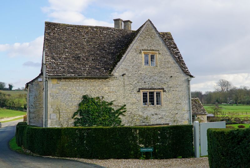
Large farmhouse, now house. Early-mid C17 with late C17-early C18 and mid-late C19 extension and out buildings. Main body: limestone rubble with dressed stone quoins; C17-C18 extension coursed squared and dressed limestone to roadside front (rubble with dressed stone quoins otherwise); mid-late C18 extension; coursed squared and dressed limestone; stone slate roof; ashlar stacks (some restored C20). 'L'-shaped plan to the main body with late C17-early C18 extension to the east gable end; C19 outbuildings adjoining the south-east corner; mid-late C19 extension in angle at the rear of the main body. Main body: 2 storeys and attic with 2-storey extensions; C19 outbuildings single storey. Garden (south front with a forward facing gable with gablet to the right: two tripartite sashes (one with a relieving arch) to the ground floor; one 2-light ovolo-moulded stone-mullioned casement with a stopped hood; two mid C18 two light casements with stopped hoods to the right of the latter. Single 2-light ovolo-moulded casements with stopped hoods to the gable and gablet. Mid-late C19 part-glazed door with marginal glazing bars and coloured and decorative frosted glass within a C20 gabled artificial stone porch off-centre right. Four-light ovolo-moulded stone-mullioned casements to the ground floor of the west gable end with similar 2 and 3-light casements above; two 3-light ovolo-moulded casements with hoods to the roadside front of the latter which is otherwise obscured by a later lean-to. Two-windowed mid-late C19 extension projects forwards slightly right with two tripartite sashes to the left-hand bay and single-light casements with glazing bars to the right-hand bay. Projecting twin diagonally set (formerly) gable-end stack and matching axial stack to the main body. Gable-end and axial stacks otherwise. Interior not inspected.
Listing NGR: SP0851309316
External links are from the relevant listing authority and, where applicable, Wikidata. Wikidata IDs may be related buildings as well as this specific building. If you want to add or update a link, you will need to do so by editing the Wikidata entry.


Other nearby listed buildings