Latitude: 51.792 / 51°47'31"N
Longitude: -2.362 / 2°21'43"W
OS Eastings: 375131
OS Northings: 210435
OS Grid: SO751104
Mapcode National: GBR 0KG.PMW
Mapcode Global: VH94P.07P2
Plus Code: 9C3VQJRQ+R6
Entry Name: Lock House
Listing Date: 30 June 1980
Grade: II
Source: Historic England
Source ID: 1340756
English Heritage Legacy ID: 132438
ID on this website: 101340756
Location: Upper Framilode, Stroud, Gloucestershire, GL2
County: Gloucestershire
District: Stroud
Civil Parish: Fretherne with Saul
Traditional County: Gloucestershire
Lieutenancy Area (Ceremonial County): Gloucestershire
Church of England Parish: Framilode St Peter
Church of England Diocese: Gloucester
Tagged with: House
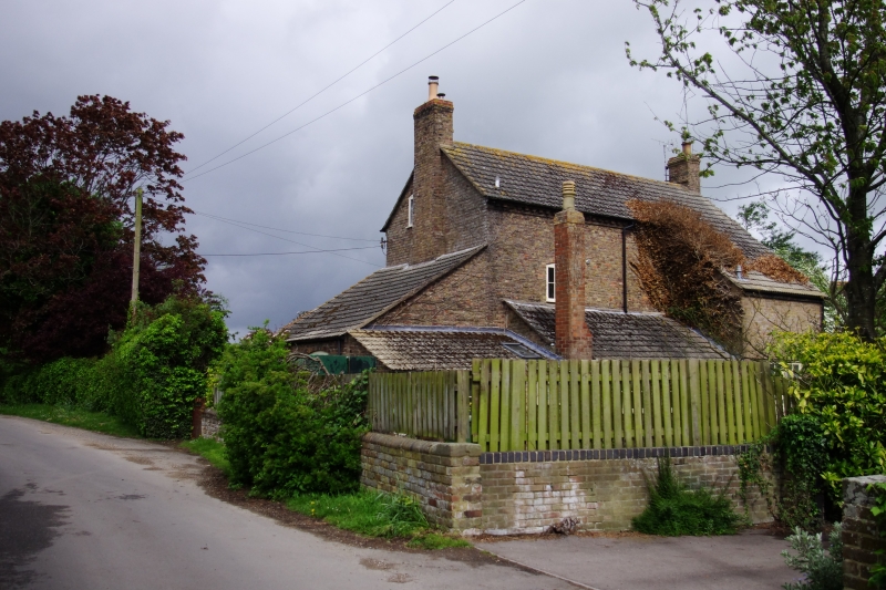
FRETHERNE WITH SAUL UPPER FRAMILODE SO 71 SE 3/179 Lock House 30.6.80 II Former lock house on Framilode Basin. 1776, built by Stroudwater Canal Company for lock-keeper Samuel Collins Junior. Brick, concrete tile roof, brick end stacks. Single main range of 2 storeys and attic in gable ends, with large lean-to to right possibly originally a joinery shop, converted to post office in C19 and now part of private house, lean-to to left of late C20 forming catslide and single-storey lean-to across remainder of rear. Brick dentil course at eaves. Three windows, 2-light cambered head wood casements to first floor, 3-light to ground floor flanking central panelled door with plain fanlight and semi-circular headed porch. Similar fenestration to side lean-to. (Michael Handford and David Viner, Stroudwater & Thames and Severn Canals Towpath Guide, 1984)
Listing NGR: SO7513110435
External links are from the relevant listing authority and, where applicable, Wikidata. Wikidata IDs may be related buildings as well as this specific building. If you want to add or update a link, you will need to do so by editing the Wikidata entry.


Other nearby listed buildings