Latitude: 51.1406 / 51°8'26"N
Longitude: 0.4515 / 0°27'5"E
OS Eastings: 571592
OS Northings: 140783
OS Grid: TQ715407
Mapcode National: GBR PSP.DYT
Mapcode Global: VHJMY.SL2G
Plus Code: 9F324FR2+6J
Entry Name: The Granary
Listing Date: 10 October 1989
Grade: II
Source: Historic England
Source ID: 1338796
English Heritage Legacy ID: 169882
ID on this website: 101338796
Location: Capel Cross, Tunbridge Wells, Kent, TN12
County: Kent
District: Tunbridge Wells
Civil Parish: Horsmonden
Traditional County: Kent
Lieutenancy Area (Ceremonial County): Kent
Church of England Parish: Horsmonden St Margaret
Church of England Diocese: Rochester
Tagged with: Granary
This list entry was subject to a Minor Amendment on 6 March 2024 to update the name and address and to reformat the text to current standards
TQ 7040-7140
7/46
HORSMONDEN
GROVEHURST LANE
GROVEHURST FARM
The Granary
(Formerly listed as Granary at Grovehurst Farm, about 50 metres north west of Grovehurst, GROVEHURST ROAD)
GV
II
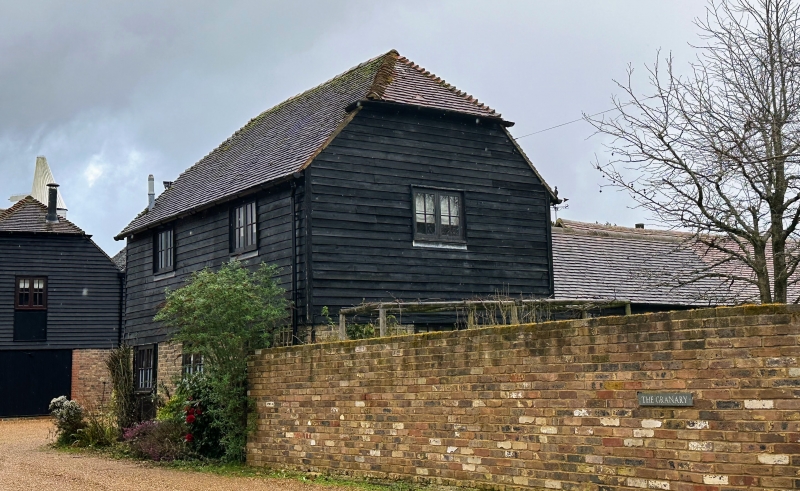
Granary. Early C19. Timber framed and weather boarded on red and blue chequered
brick base with plain tiled roof. Two storeys with half-hipped roof. Two wooden casements on first floor of long side, with central casement on ground floor and boarded doors to left and to right, both with strap hinges. Boarded doors on both floors in gable end to right, that on ground floor in C20 brick outshot with pentice over.
Listing NGR: TQ7159240783
External links are from the relevant listing authority and, where applicable, Wikidata. Wikidata IDs may be related buildings as well as this specific building. If you want to add or update a link, you will need to do so by editing the Wikidata entry.


Other nearby listed buildings