Latitude: 51.8167 / 51°49'0"N
Longitude: 1.1875 / 1°11'15"E
OS Eastings: 619792
OS Northings: 217924
OS Grid: TM197179
Mapcode National: GBR VS5.11F
Mapcode Global: VHLCZ.JLNP
Plus Code: 9F33R58Q+M2
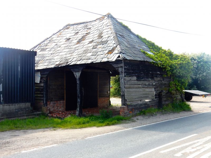
Entry Name: Cartlodge Opposite and Approximately 30 Metres North West of Sladbury's Old House
Listing Date: 4 July 1986
Grade: II
Source: Historic England
Source ID: 1337148
English Heritage Legacy ID: 119873
ID on this website: 101337148
Location: Tendring, Essex, CO15
County: Essex
District: Tendring
Electoral Ward/Division: Burrsville
Parish: Non Civil Parish
Traditional County: Essex
Lieutenancy Area (Ceremonial County): Essex
Church of England Parish: Holland-on-Sea St Bartholomew
Church of England Diocese: Chelmsford
Tagged with: Carriage house
CLACTON-ON-SEA SLADBIJRY'S LANE TM 11 NE 7/13 Cartlodge opposite and approx. 30 metres north-west of Sladbury's Old House GV II Cartlodge. C18. Timber framed, hipped grey slate roof. The 3 northern bays open to east and west, the solid arched braces to top plate giving an arcade effect. The southern bays weatherboarded with brick plinth.
Listing NGR: TM1979217924
External links are from the relevant listing authority and, where applicable, Wikidata. Wikidata IDs may be related buildings as well as this specific building. If you want to add or update a link, you will need to do so by editing the Wikidata entry.


Other nearby listed buildings