Latitude: 51.0505 / 51°3'1"N
Longitude: -0.9014 / 0°54'5"W
OS Eastings: 477100
OS Northings: 128478
OS Grid: SU771284
Mapcode National: GBR CBS.0XX
Mapcode Global: FRA 960B.LNN
Plus Code: 9C3X332X+5C
Entry Name: Spread Eagle Public House
Listing Date: 18 March 1992
Grade: II
Source: Historic England
Source ID: 1337020
English Heritage Legacy ID: 354810
Also known as: The Spread Eagle, Liss
Spread Eagle
ID on this website: 101337020
Location: West Liss, East Hampshire, GU33
County: Hampshire
District: East Hampshire
Civil Parish: Liss
Built-Up Area: Liss
Traditional County: Hampshire
Lieutenancy Area (Ceremonial County): Hampshire
Church of England Parish: Liss St Mary
Church of England Diocese: Portsmouth
Tagged with: Pub
The following building shall be added:-
LISS SU 72 NE UPPER GREEN 1068-10/10001 Spread Eagle Public House - II
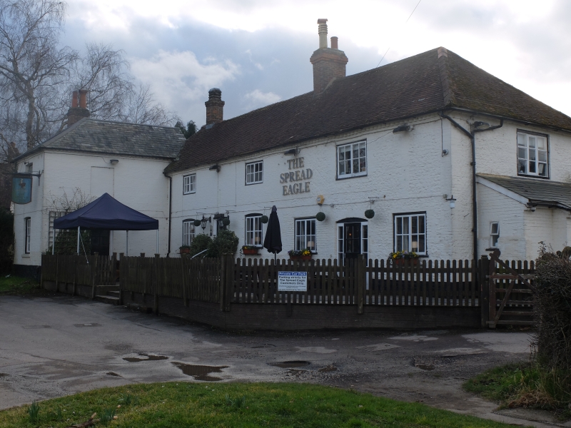
Public house. Cellar C16, main range early C18 but with projecting early C19 wing to left over C15 core. Early C18 main range is a 3 bay baffle entrance structure built of stone with brick dressings, painted to front. Hipped tiled roof with brick stacks. Plinth 2:3 C19 casements with shutters and 2 doors. Projecting C19 wing is of painted brick with slate roof but has to rear section of lower elevation with steeply pitched tiled roof. Front has 1 16 pane sash, cambered to ground floor and with shutters to first floor. Interior of early C18 wing has exposed axial beams with 2 inch chamfers and lambs tongue stop, a wooden seat at either side and C18 3 plank door to side with old hinges. Doors and ironmongery reported to 1st floor. C15 dairy now forming cellar with solid tread stairs reported but not seen.
Listing NGR: SU7709828477
External links are from the relevant listing authority and, where applicable, Wikidata. Wikidata IDs may be related buildings as well as this specific building. If you want to add or update a link, you will need to do so by editing the Wikidata entry.


Other nearby listed buildings