Latitude: 51.3521 / 51°21'7"N
Longitude: 1.0226 / 1°1'21"E
OS Eastings: 610567
OS Northings: 165786
OS Grid: TR105657
Mapcode National: GBR TX7.1CX
Mapcode Global: VHKJR.N8ZT
Plus Code: 9F33922F+R2
Entry Name: Granary House
Listing Date: 20 May 1977
Grade: II
Source: Historic England
Source ID: 1336855
English Heritage Legacy ID: 170797
ID on this website: 101336855
Location: Lower Island, Canterbury, Kent, CT5
County: Kent
District: Canterbury
Electoral Ward/Division: Gorrell
Parish: Non Civil Parish
Built-Up Area: Whitstable
Traditional County: Kent
Lieutenancy Area (Ceremonial County): Kent
Tagged with: House
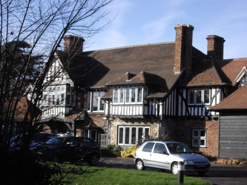
CANTERBURY ROAD 1. 5273 (North-West Side) Granary House TR 16 NW 4/80 II 2. Early C17 brick horse having tile hung 1st floor, old clay tiled roof and tall brick chimneys. Large gable and bay, lead light windows. Much restored with modern atone projecting wing at front and double dormer over at 1st floor.
Listing NGR: TR1056765786
External links are from the relevant listing authority and, where applicable, Wikidata. Wikidata IDs may be related buildings as well as this specific building. If you want to add or update a link, you will need to do so by editing the Wikidata entry.


Other nearby listed buildings