Latitude: 51.338 / 51°20'16"N
Longitude: 1.4061 / 1°24'22"E
OS Eastings: 637337
OS Northings: 165391
OS Grid: TR373653
Mapcode National: GBR X0L.2B5
Mapcode Global: VHMCW.BM6M
Plus Code: 9F338CQ4+6C
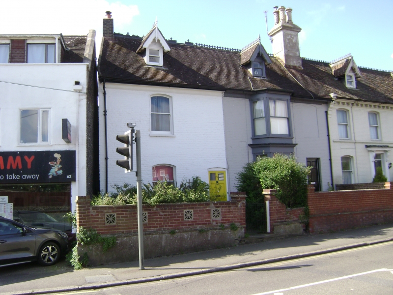
Entry Name: 64 and 64A, Park Road
Listing Date: 4 February 1988
Grade: II
Source: Historic England
Source ID: 1336681
English Heritage Legacy ID: 171933
ID on this website: 101336681
Location: Nethercourt, Thanet, Kent, CT11
County: Kent
District: Thanet
Civil Parish: Ramsgate
Built-Up Area: Ramsgate
Traditional County: Kent
Lieutenancy Area (Ceremonial County): Kent
Tagged with: Building
RAMSGATE PARK ROAD TR 3765 SW (south side) 7/300 Nos. 64 and 64A GV II House pair. C18 altered mid C19. Painted brick in irregular bond with plain tiled roof. Two storeys, attic and basement, with moulded eaves cornice to roof with 2 bargeboarded dormers and panelled stack to centre right. Segmentally headed sash and blank window space on 1st floor, with segmentally headed sash to left on ground floor. Two storey canted bay to centre right. Part glazed 6 panelled door to left, and half-glazed door to right. The internal structure shows this to be an early addition to No. 66, the whole block treated with similar details (especially the roof) in Cl9. (See item 7/299).
Listing NGR: TR3733765391
External links are from the relevant listing authority and, where applicable, Wikidata. Wikidata IDs may be related buildings as well as this specific building. If you want to add or update a link, you will need to do so by editing the Wikidata entry.


Other nearby listed buildings