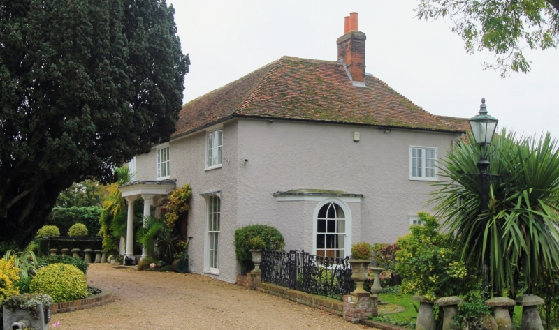
Latitude: 51.2949 / 51°17'41"N
Longitude: 1.0513 / 1°3'4"E
OS Eastings: 612831
OS Northings: 159512
OS Grid: TR128595
Mapcode National: GBR TXV.NML
Mapcode Global: VHLGF.5QN5
Plus Code: 9F3373V2+XG
Entry Name: Moat House
Listing Date: 14 March 1980
Grade: II
Source: Historic England
Source ID: 1336583
English Heritage Legacy ID: 171413
ID on this website: 101336583
Location: Rough Common, Canterbury, Kent, CT2
County: Kent
District: Canterbury
Civil Parish: Harbledown and Rough Common
Built-Up Area: Canterbury
Traditional County: Kent
Lieutenancy Area (Ceremonial County): Kent
Tagged with: House
1. 5273 ST COSMUS AND ST DAMIAN IN THE BLEAN ROUGH COMMON ROAD
Moat House TR 15 NW 8/554
II
2. Circa 1800. Two storeys faced with roughcast. Hipped slate roof. Three windows. Casement windows on first floor, sashes with glazing baRs intact on ground floor. Doorcase with side lights, segmental fanlight and door of 6 moulded and fielded panels.
Listing NGR: TR1192961445
External links are from the relevant listing authority and, where applicable, Wikidata. Wikidata IDs may be related buildings as well as this specific building. If you want to add or update a link, you will need to do so by editing the Wikidata entry.


Other nearby listed buildings