Latitude: 51.2811 / 51°16'51"N
Longitude: 1.0592 / 1°3'32"E
OS Eastings: 613440
OS Northings: 157994
OS Grid: TR134579
Mapcode National: GBR TY1.QKR
Mapcode Global: VHLGM.92S7
Plus Code: 9F3373J5+CM
Entry Name: Pennyless Bench
Listing Date: 14 March 1980
Grade: II
Source: Historic England
Source ID: 1336521
English Heritage Legacy ID: 171179
ID on this website: 101336521
Location: St Dunstan's, Canterbury, Kent, CT2
County: Kent
District: Canterbury
Civil Parish: Harbledown and Rough Common
Built-Up Area: Canterbury
Traditional County: Kent
Lieutenancy Area (Ceremonial County): Kent
Tagged with: Architectural structure
1. 5273 HARBLEDOWN SUMMER HILL (south side)
No 1 (Pennyless Bench) TR 15 NW 8/370
II GV
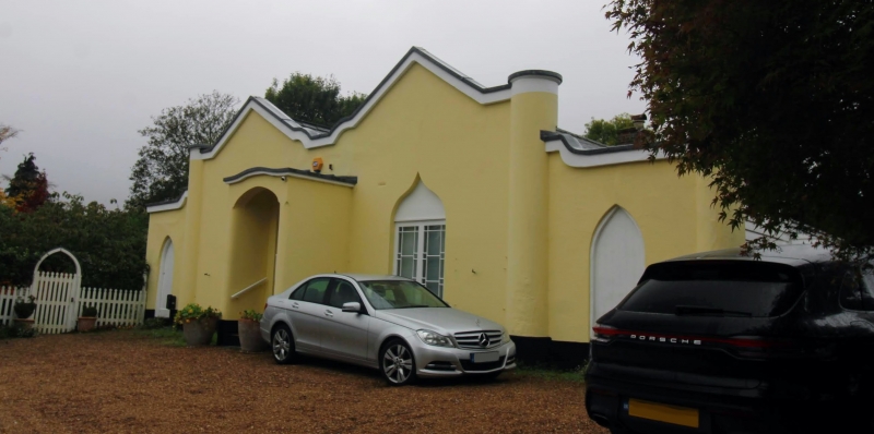
2. A lodge circa 1840. One storey stuccoed. Slate roof with 2 gables. Two windows having ogee-shaped heads with decorative glazing. Weather porch having central doorcase with elliptical fanlight.
Listing NGR: TR1343857996
External links are from the relevant listing authority and, where applicable, Wikidata. Wikidata IDs may be related buildings as well as this specific building. If you want to add or update a link, you will need to do so by editing the Wikidata entry.


Other nearby listed buildings