Latitude: 51.3311 / 51°19'52"N
Longitude: 1.4121 / 1°24'43"E
OS Eastings: 637786
OS Northings: 164644
OS Grid: TR377646
Mapcode National: GBR X0L.HTR
Mapcode Global: VHMCW.FSCX
Plus Code: 9F338CJ6+FR
Entry Name: The Artillery Arms
Listing Date: 8 October 1972
Grade: II
Source: Historic England
Source ID: 1336327
English Heritage Legacy ID: 171996
Also known as: Artillery Arms
Artillery Arms, Ramsgate
ID on this website: 101336327
Location: Ramsgate, Thanet, Kent, CT11
County: Kent
District: Thanet
Civil Parish: Ramsgate
Built-Up Area: Ramsgate
Traditional County: Kent
Lieutenancy Area (Ceremonial County): Kent
Tagged with: Pub
This list entry was subject to a Minor Amendment on 23 September 2024 to update the name and address and reformat the text to current standards.
TR 3764 NE
12/360
RAMSGATE
WEST CLIFF ROAD (east side)
No. 36, The Artillery Arms
(Formerly listed as ROYAL ROAD (east side), No. 36 (The Artillery Arms))
8.10.72
GV
II
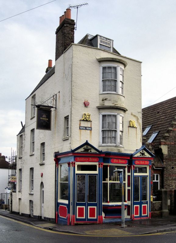
Public house. Circa 1840. Painted brick with slate roof. Three storeys and basement with parapet to hipped roof and stacks to left and to rear. Two storey bow with glazing bar sashes on first and second floors. Ground floor pub front wrapped around front and returned to side elevations, with panelled aprons to frosted and stained glass windows with pilaster piers to fascia and cornice, with pediments containing relief of cannons over panelled and glazed doors on left and right corners. Left return (to West Cliff Road) with sash above panelled front, glazing bar sash over half-glazed door with semi-circular fanlight, and glazing bar sashes on each floor to left and also in two storey end wing.
Listing NGR: TR3778664644
External links are from the relevant listing authority and, where applicable, Wikidata. Wikidata IDs may be related buildings as well as this specific building. If you want to add or update a link, you will need to do so by editing the Wikidata entry.


Other nearby listed buildings