Latitude: 54.2666 / 54°15'59"N
Longitude: -2.8679 / 2°52'4"W
OS Eastings: 343568
OS Northings: 486002
OS Grid: SD435860
Mapcode National: GBR 8MD3.XB
Mapcode Global: WH836.X1H0
Plus Code: 9C6V748J+JR
Entry Name: Farm Buildings Immediately to West of Witherslack Hall Farmhouse
Listing Date: 12 February 1962
Last Amended: 3 April 1989
Grade: II
Source: Historic England
Source ID: 1335811
English Heritage Legacy ID: 77134
ID on this website: 101335811
Location: Witherslack, Westmorland and Furness, Cumbria, LA11
County: Westmorland and Furness
District: South Lakeland
Civil Parish: Witherslack, Meathop and Ulpha
Traditional County: Westmorland
Lieutenancy Area (Ceremonial County): Cumbria
Church of England Parish: Witherslack St Paul
Church of England Diocese: Carlisle
Tagged with: Agricultural structure
WITHERSLACK SD 48 NW 3/46 Farm buildings 12.2.62 immediately to west of Witherslack Hall Farmhouse (q.v.) (formerly listed with the farmhouse)
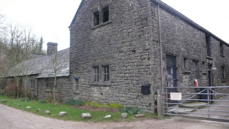
G.V. II Farm buildings. Probably mid to late C19. Dressed limestone with rock-faced dressings, slate roofs, much replaced by corrugated iron. Quadrangular plan with wings to north and east. South elevation of single storey and 5 bays, the 5th bay of 2 storeys under gable. Rock-faced mullions and lintels to 3:3:2-light windows. 4th bay breaks forward with casement; 2-light windows to end bay. Canted south-west angle. 2-storey east elevation has central through passage; stable door to either side has loading door over, windows have louvred openings over. 2-storey west elevation has gabled 1st bay with 3-light windows, projecting entrance with paired doors to 2nd bay; 4 windows and pitching holes flanking loading door. 2-storey north elevation has some 3-light windows and single storey east and north ranges on small courtyard; large openings. East wing of 2 storeys has large entrances; small single storey south projection with yet smaller single storey east projection. Courtyard has outshut under catslide roof to east; with gable over former entrance. Stabling and loose boxes remain to east range, cowhouses to outshut and south range.
Listing NGR: SD4356886002
External links are from the relevant listing authority and, where applicable, Wikidata. Wikidata IDs may be related buildings as well as this specific building. If you want to add or update a link, you will need to do so by editing the Wikidata entry.


Other nearby listed buildings