Latitude: 51.878 / 51°52'40"N
Longitude: -0.8338 / 0°50'1"W
OS Eastings: 480375
OS Northings: 220581
OS Grid: SP803205
Mapcode National: GBR D24.617
Mapcode Global: VHDTY.H2K4
Plus Code: 9C3XV5H8+6F
Entry Name: Mary Monks Close
Listing Date: 21 December 1967
Last Amended: 29 January 1985
Grade: II
Source: Historic England
Source ID: 1332750
English Heritage Legacy ID: 42358
ID on this website: 101332750
Location: Whitchurch, Buckinghamshire, HP22
County: Buckinghamshire
Civil Parish: Whitchurch
Built-Up Area: Whitchurch
Traditional County: Buckinghamshire
Lieutenancy Area (Ceremonial County): Buckinghamshire
Church of England Parish: Whitchurch with Creslow
Church of England Diocese: Oxford
Tagged with: Building
SP 8020 WHITCHURCH HIGH STREET (east side)
9/210 No. 12. (Mary Monks Close)(formerly listed as No.20) 21.12.67
- II
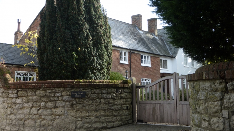
House. Late C18, altered and extended. Red brick with tuck pointing, moulded plinth and moulded wooden eaves cornice with ornamental dentils. Slate roof, flanking brick chimneys. 2 storeys and attic, 3 bays. C19 barred wooden casements, 3-light flanking 2-light, ground floor windows with lozenge panes in top-lights and gauged brick heads. Central ground floor window has altered head, probably once over front door. 2-light wooden casement to attic in left gable. Additional bay to right is rendered and whitewashed with 3-light leaded casement over fine 6-panelled door. Door has semi-circular radiating fanlight in depressed arch, panelled reveals, flanking Doric pilasters, and C20 entablature hood with triglyph frieze. Gabled cross wing of c.1911 to far right is also rendered and whitewashed, with asbestos slate roof and barred sash windows. Rear much altered C20.
Listing NGR: SP8037520581
External links are from the relevant listing authority and, where applicable, Wikidata. Wikidata IDs may be related buildings as well as this specific building. If you want to add or update a link, you will need to do so by editing the Wikidata entry.


Other nearby listed buildings