Latitude: 52.1492 / 52°8'57"N
Longitude: -0.6998 / 0°41'59"W
OS Eastings: 489059
OS Northings: 250896
OS Grid: SP890508
Mapcode National: GBR CZ0.9WL
Mapcode Global: VHDSN.T7DS
Plus Code: 9C4X48X2+M3
Entry Name: Mill House
Listing Date: 3 March 1952
Last Amended: 6 May 1983
Grade: II
Source: Historic England
Source ID: 1332288
English Heritage Legacy ID: 45687
ID on this website: 101332288
Location: Milton Keynes, Buckinghamshire, MK46
County: Milton Keynes
Civil Parish: Olney
Built-Up Area: Olney
Traditional County: Buckinghamshire
Lieutenancy Area (Ceremonial County): Buckinghamshire
Church of England Parish: Olney
Church of England Diocese: Oxford
Tagged with: House
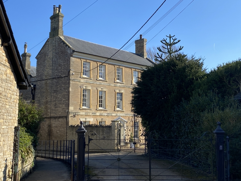
OLNEY CHURCH STREET SP 8950 2/13 3.3.52 Mill House (formerly listed as Olney Mill (House and Mill)) II Late C18. Stone, slate roof with coped gables, shaped kneelers, moulded wooden eaves cornice with dentil course, yellow brick end chimney stacks, three storeys, floor bands. Central 6-panelled door with semi-circular fanlight, moulded frame and panelled reveals, wooden doorcase with reeded pilasters and consoles supporting a triangular pediment broken beneath. Sash windows in flat eaves architraves with fluted keystones and plain cills; two each side of door and five to both upper floors. Double pile house, 2-storey rear block with central 6-panel door with flat hood on cut brackets, tripartite sash window each side and two to first floor all with flat stone arches with keystones.
Listing NGR: SP8905950896
External links are from the relevant listing authority and, where applicable, Wikidata. Wikidata IDs may be related buildings as well as this specific building. If you want to add or update a link, you will need to do so by editing the Wikidata entry.


Other nearby listed buildings