Latitude: 53.3537 / 53°21'13"N
Longitude: -2.6371 / 2°38'13"W
OS Eastings: 357690
OS Northings: 384277
OS Grid: SJ576842
Mapcode National: GBR BY0N.WJ
Mapcode Global: WH98Q.GYGW
Plus Code: 9C5V9937+F5
Entry Name: Village Farm House
Listing Date: 8 January 1970
Grade: II
Source: Historic England
Source ID: 1330360
English Heritage Legacy ID: 56006
ID on this website: 101330360
Location: Moore, Halton, Cheshire, WA4
County: Halton
Civil Parish: Moore
Built-Up Area: Moore
Traditional County: Cheshire
Lieutenancy Area (Ceremonial County): Cheshire
Church of England Parish: Daresbury All Saints
Church of England Diocese: Chester
Tagged with: Farmhouse
SJ 58 SE MOORE C.P. RUNCORN ROAD (North Side) 6/51 No.128 (Village Farm House)
8.1.70 II
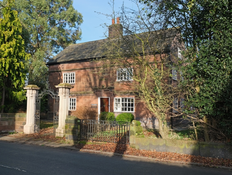
Farm House now ordinary dwelling late C17 with alterations, stone with stone slate roof. 2 storeys and attic. formerly four bays but original openings built up and new windows inserted. Stone plinth, rusticated quoins, string courses above ground floor and first floor windows, raised over entrance door. Six panel door, renewed casement windows. Panel over door contains carved stone sphere and there are two interlaced ring features above the second floor cornice. Sandstone ridge and central brick stack.
Interior: Ovolo moulded and stopped bevelled beams, carved beam over ingle nook. Jacobean style landing balustrade, some oak flooring.
Listing NGR: SJ5769084277
External links are from the relevant listing authority and, where applicable, Wikidata. Wikidata IDs may be related buildings as well as this specific building. If you want to add or update a link, you will need to do so by editing the Wikidata entry.


Other nearby listed buildings