Latitude: 53.2934 / 53°17'36"N
Longitude: -2.5055 / 2°30'19"W
OS Eastings: 366405
OS Northings: 377501
OS Grid: SJ664775
Mapcode National: GBR BZYC.C3
Mapcode Global: WH995.HH42
Plus Code: 9C5V7FVV+9R
Entry Name: 24, High Street
Listing Date: 27 August 1986
Grade: II
Source: Historic England
Source ID: 1329868
English Heritage Legacy ID: 57537
ID on this website: 101329868
Location: Great Budworth, Cheshire West and Chester, Cheshire, CW9
County: Cheshire West and Chester
Civil Parish: Great Budworth
Traditional County: Cheshire
Lieutenancy Area (Ceremonial County): Cheshire
Church of England Parish: Great Budworth St Mary and All Saints
Church of England Diocese: Chester
SJ 67 NE GREAT BUDWORTH C.P. HIGH STREET South Side
6/73 No. 24
-
GV II
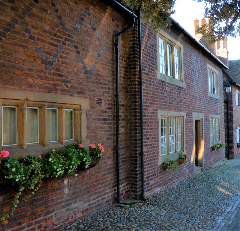
House, formerly public house, largely late C19. Flemish bond brown brick; graded grey slate roof. 2 storeys of 2 windows. plus slightly lower left wing, of 1 window to lower storey only, with rear wing at right angles. Yellow sandstone shouldered and eared surrounds to recessed-mullioned 3-light small-pane windows; bars removed from centre lights of upper windows; similar window in left wing with four lights; door; blue brick diapering between upper windows in main block and above window of left wing. No. 24 is the terminal pre-C20 building on the north side of High Street; some detailing may be early C20, but the building appears to be as shown on the 1st Edition OS 1/2500 map (1875). Included for group value.
Listing NGR: SJ6640577496
External links are from the relevant listing authority and, where applicable, Wikidata. Wikidata IDs may be related buildings as well as this specific building. If you want to add or update a link, you will need to do so by editing the Wikidata entry.


Other nearby listed buildings