Latitude: 54.5947 / 54°35'40"N
Longitude: -1.0361 / 1°2'10"W
OS Eastings: 462376
OS Northings: 522591
OS Grid: NZ623225
Mapcode National: GBR PH69.GQ
Mapcode Global: WHF81.1SW1
Plus Code: 9C6WHXV7+VH
Entry Name: Farm Buildings and Two Houses Circa 50 Metres North of Ryehills Farmhouse
Listing Date: 29 April 1988
Grade: II
Source: Historic England
Source ID: 1329632
English Heritage Legacy ID: 60351
ID on this website: 101329632
Location: Redcar and Cleveland, North Yorkshire, TS11
County: Redcar and Cleveland
Electoral Ward/Division: Longbeck
Parish: Non Civil Parish
Traditional County: Yorkshire
Lieutenancy Area (Ceremonial County): North Yorkshire
Church of England Parish: Redcar St Peter
Church of England Diocese: York
Tagged with: House Agricultural structure
REDCAR REDCAR ROAD north NZ 62 SW side (off), Marske 5/99 Farm buildings and 2 houses c.50m north of Ryehills Farmhouse. G.V. II
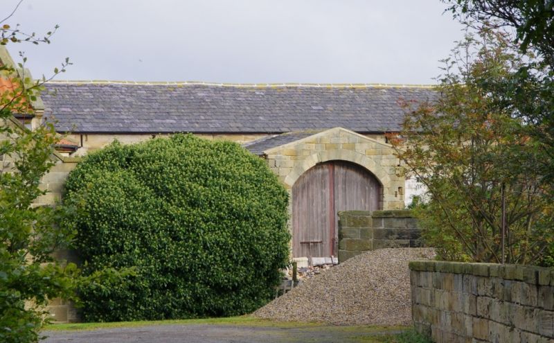
Barn and byre range, c.1800, with later C19 stable/granary and cart shed flanking porch of barn; engine house adjoining rear of barn, and stable adjoining left byre. End byres and rear extensions converted to dwellings, that at right end extended to rear; links to barn raised by one storey c.1985. Chevron-tooled dressed sandstone. Roofs of,Welsh slate in diminishing courses; renewed clay pantiles on houses. Stone ridge and gable copings. Symmetrical, on 3 sides of octagonal yard. Barn has central gabled projecting porch with boarded double doors in segment-arched opening. Right single-storey, 3-bay, lean-to cart shed with plain piers, and left 2-storey, 3-bay, lean-to stable/granary, flank the porch. Stable/granary has off-centre boarded door and altered hit-and-miss and louvred windows. 2-storey, 3-bay houses at ends of range, have pilaster strips at angles, segment-arched openings, now partly blocked and holding stone-mullioned windows, on ground floor. Original first-floor windows now hold mullioned casements. One-bay links to houses have doorways with segment-headed lintels under keyed lintels. Hipped and gabled roofs, houses sprocketed at eaves. One-storey, single-bay wing adjoins left of left house. Rear of barn shows central doorway with plain pedimented surround. Slit breathers on ground floor, below eaves, and in gable ends. Single-storey, lean-to engine house adjoins right of doorway. Barn, cart shed and stable/granary disused and dilapidated at time of resurvey. Remains of milking parlour adjoining south-west corner of range, is too derelict to be of special interest.
Listing NGR: NZ6237622591
External links are from the relevant listing authority and, where applicable, Wikidata. Wikidata IDs may be related buildings as well as this specific building. If you want to add or update a link, you will need to do so by editing the Wikidata entry.


Other nearby listed buildings