Latitude: 54.5904 / 54°35'25"N
Longitude: -1.0796 / 1°4'46"W
OS Eastings: 459570
OS Northings: 522077
OS Grid: NZ595220
Mapcode National: GBR NHXC.17
Mapcode Global: WHF80.DW39
Plus Code: 9C6WHWRC+54
Entry Name: Bastion and Adjoining Ha Ha Wall 150 Metres North of Kirkleatham Hall Farm
Listing Date: 23 June 1952
Grade: II*
Source: Historic England
Source ID: 1329608
English Heritage Legacy ID: 60329
ID on this website: 101329608
Location: Kirkleatham, Redcar and Cleveland, North Yorkshire, TS10
County: Redcar and Cleveland
Electoral Ward/Division: Dormanstown
Parish: Non Civil Parish
Traditional County: Yorkshire
Lieutenancy Area (Ceremonial County): North Yorkshire
Church of England Parish: Kirkleatham
Church of England Diocese: York
Tagged with: Architectural structure
REDCAR KIRKLEATHAM NZ 52 SE 4/73 Bastion and adjoining ha-ha wall, 150m. north 23.6.52 of Kirkleatham Hall Farm. G.V. II*
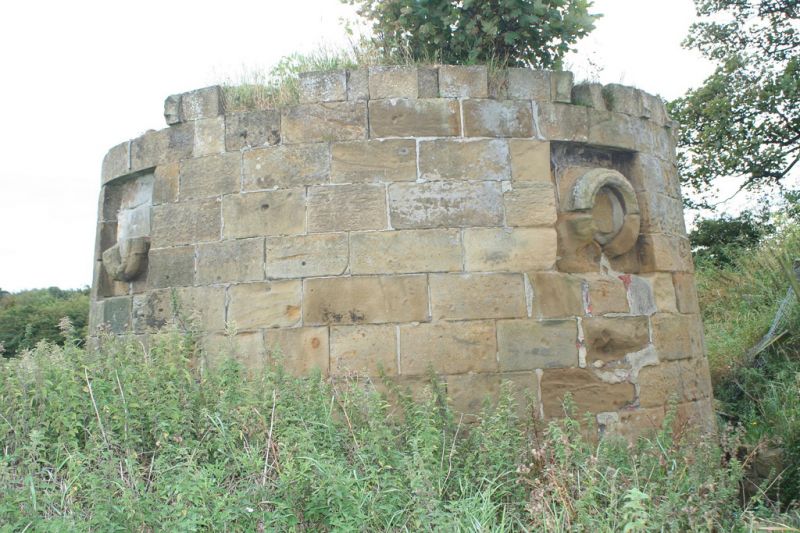
Bastion and adjoining ha-ha wall, early/mid C18, as garden ornaments and for defence against threat of invasion by French privateers. Dressed sandstone; brick internal vault, flanking wall and parapet to external stair. Gothick style. Short tapered circular tower. Round openings with mock cannon-barrel surrounds in square recesses, in north and west sides, that in east side now missing. Pointed doorway in south side. Corbel table supports projecting parapet, originally embattled but merlons and embrasures now missing. Flat paved roof has remains of surrounding benches. Stair and bridge/porch, adjoining south side, now partly demolished. Interior has segmental-vaulted ceiling. Ha-ha wall runs west for 120m, from north side of tower. West end of wall missing or obscured by forestry work. Disused and dilapidated at time of resurvey. Bastion shown with bridge/porch and stair intact in N.M.R. photograph AA53/12864:1953.
Listing NGR: NZ5957022077
External links are from the relevant listing authority and, where applicable, Wikidata. Wikidata IDs may be related buildings as well as this specific building. If you want to add or update a link, you will need to do so by editing the Wikidata entry.


Other nearby listed buildings