Latitude: 50.2175 / 50°13'2"N
Longitude: -5.2279 / 5°13'40"W
OS Eastings: 169820
OS Northings: 40261
OS Grid: SW698402
Mapcode National: GBR Z3.FHS8
Mapcode Global: VH12K.BSKN
Plus Code: 9C2P6Q8C+XR
Entry Name: Copper Hill House
Listing Date: 12 September 1989
Grade: II
Source: Historic England
Source ID: 1328180
English Heritage Legacy ID: 66814
ID on this website: 101328180
Location: Cornwall, TR16
County: Cornwall
Civil Parish: Redruth
Traditional County: Cornwall
Lieutenancy Area (Ceremonial County): Cornwall
Church of England Parish: Redruth
Church of England Diocese: Truro
Tagged with: House
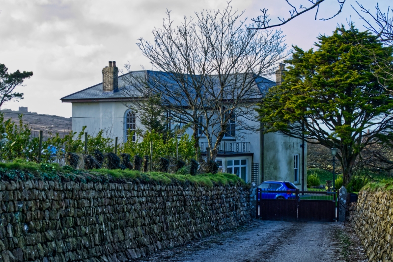
REDRUTH COPPER HILL SW 64 SE (north side) 5/259 Copper Hill House II House. Probably mid to later C19. Killas rubble brought to courses, mostly rendered and painted white, with granite dressings, scantle slate roof and chimneys of yellow brick. L-plan formed by main range on east-west axis with wing on north side. Two storeys; the unrendered symmetrical 3-bay north facade (to garden) has a plinth and rock-faced quoins, three 4-pane sashed windows at ground floor and 2 above with a blind window in the centre, all with rock-faced quoined surrounds and lintels; hipped roof with projecting eaves and side-wall chimneys. The entrance is in the south-east angle, covered by a modern flat-roofed porch; the rear wall has one window at 1st floor, the wing has one at ground floor and 2 above, all 4-pane sashes. The end wall of the wing has a very large round-headed sashed stairwindow with intersecting glazing bars (above a flat-roofed extension which is not of special interest); the 3-bay west side wall has a doorway in the centre and 4-pane sashed windows on both floors (that to left at 1st floor segmental-headed). Interior not inspected. History: probably associated with Wheal Buller copper mine, of which there are remains within a radius of approx. 200 metres north and west.
Listing NGR: SW6982040261
External links are from the relevant listing authority and, where applicable, Wikidata. Wikidata IDs may be related buildings as well as this specific building. If you want to add or update a link, you will need to do so by editing the Wikidata entry.


Other nearby listed buildings