Latitude: 50.3743 / 50°22'27"N
Longitude: -4.964 / 4°57'50"W
OS Eastings: 189340
OS Northings: 56917
OS Grid: SW893569
Mapcode National: GBR ZL.ZFBL
Mapcode Global: FRA 08H1.V7V
Plus Code: 9C2Q92FP+PC
Entry Name: Glebe Farmhouse
Listing Date: 12 May 1988
Grade: II
Source: Historic England
Source ID: 1327415
English Heritage Legacy ID: 71296
ID on this website: 101327415
Location: St Enoder, Cornwall, TR8
County: Cornwall
Civil Parish: St. Enoder
Traditional County: Cornwall
Lieutenancy Area (Ceremonial County): Cornwall
Church of England Parish: St Enoder
Church of England Diocese: Truro
Tagged with: Farmhouse
ST ENODER SW 85 NE 11/296 Glebe Farmhouse - II
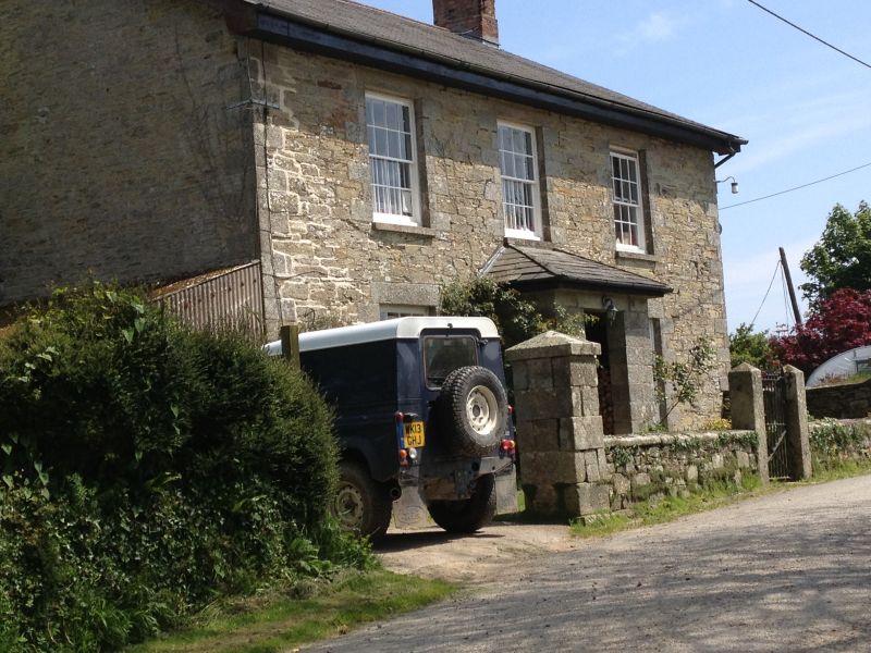
Farmhouse. Mid C19 with some C20 alterations. Stone rubble with granite dressings and quoins. The right side rendered. Slate roof with ridge tiles and gable ends; deep eaves. Gable end stacks with brick shafts. Plan: Double depth plan, with central entrance and principal room to front left and right. To rear right the kitchen and the dairy to rear left; rear central stair. Attached to rear centre is small single storey outhouse heated from a gable end stack. Exterior: 2 storeys, symmetrical 3-window front; all windows are C19 16-pane sashes with granite lintels. Central C19 open-fronted porch with hipped roof and inner half-glazed C20 door. The left side has 2-light 6-pane casement at ground floor to left and C20 garage attached to right. The right side is blind. At the rear, first floor has three C19 16-pane sashes and smaller 12-pane sash to left. Ground floor has C20 window to left and 16-pane sash to right. Single storey attached outhouse with C20 door and window and gable end stack with brick shaft. Interior: Not inspected.
Listing NGR: SW8934256916
External links are from the relevant listing authority and, where applicable, Wikidata. Wikidata IDs may be related buildings as well as this specific building. If you want to add or update a link, you will need to do so by editing the Wikidata entry.


Other nearby listed buildings