Latitude: 51.2739 / 51°16'25"N
Longitude: 1.3368 / 1°20'12"E
OS Eastings: 632833
OS Northings: 158038
OS Grid: TR328580
Mapcode National: GBR X18.2SJ
Mapcode Global: VHLGS.471S
Plus Code: 9F3378FP+HP
Entry Name: 33, Moat Sole
Listing Date: 23 April 1976
Grade: II
Source: Historic England
Source ID: 1325943
English Heritage Legacy ID: 177561
ID on this website: 101325943
Location: Sandwich, Dover, Kent, CT13
County: Kent
District: Dover
Civil Parish: Sandwich
Built-Up Area: Sandwich
Traditional County: Kent
Lieutenancy Area (Ceremonial County): Kent
Tagged with: Building
1. 5275 MOAT SOLE (East Side No 33 TR 3258 1/320
II
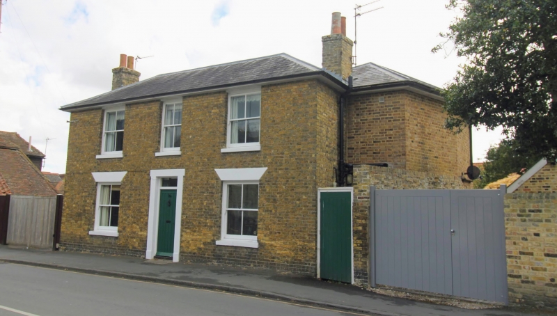
2. Circa 1860. 2 storey yellow brick building with slate roof. Flat plastered arches over ground floor windows. 5 windows in all with glazing bars forming 4 squares each. Doorway, plain pilasters and head, fluted door with square fanlight over.
Listing NGR: TR3283458035
External links are from the relevant listing authority and, where applicable, Wikidata. Wikidata IDs may be related buildings as well as this specific building. If you want to add or update a link, you will need to do so by editing the Wikidata entry.


Other nearby listed buildings