Latitude: 54.5415 / 54°32'29"N
Longitude: -1.7811 / 1°46'52"W
OS Eastings: 414257
OS Northings: 516268
OS Grid: NZ142162
Mapcode National: GBR JH0X.5S
Mapcode Global: WHC5S.M31R
Plus Code: 9C6WG6R9+HG
Entry Name: Winston Bridge
Listing Date: 14 September 1966
Grade: II*
Source: Historic England
Source ID: 1323060
English Heritage Legacy ID: 111140
ID on this website: 101323060
Location: Winston, County Durham, DL2
County: County Durham
Civil Parish: Barforth
Traditional County: Yorkshire
Lieutenancy Area (Ceremonial County): County Durham
Church of England Parish: Forcett with Aldborough and Melsonby
Church of England Diocese: Leeds
NZ 11 NW WINSTON B6274
5/49 Winston Bridge 14.9.66 II*
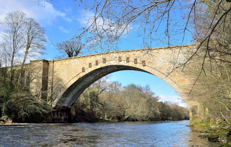
Road bridge crossing the River Tees. 1762-3 by Sir Thomas Robinson. Dressed sandstone. Slightly-recessed, single semicircular arch spans 34 metres and has archivolt defined by finely-jointed voussoirs. Arch now stabilised by 8 iron tie rods and plates. Identical north and south faces have massive rectangular-plan piers and buttressed raking sections to east and west. Parapet has slightly-projecting coping carried on square brackets and is cambered over the arch, breaking forward over the piers to form pedestrian refuges. East and west ends of bridge terminate in low square-plan piers with pyramidal caps. West end of bridge is slightly canted on plan.
Winston Bridge straddles the parished of-Winston and Barforth.
Listing NGR: NZ1425716268


Other nearby listed buildings