Latitude: 54.6117 / 54°36'42"N
Longitude: -2.0693 / 2°4'9"W
OS Eastings: 395622
OS Northings: 524062
OS Grid: NY956240
Mapcode National: GBR FHZ3.SM
Mapcode Global: WHB44.5BWY
Plus Code: 9C6VJW6J+M7
Entry Name: The Old Vicarage
Listing Date: 17 June 1986
Grade: II
Source: Historic England
Source ID: 1323048
English Heritage Legacy ID: 111286
ID on this website: 101323048
Location: Laithkirk, County Durham, DL12
County: County Durham
Civil Parish: Lunedale
Traditional County: Yorkshire
Lieutenancy Area (Ceremonial County): County Durham
Tagged with: Clergy house
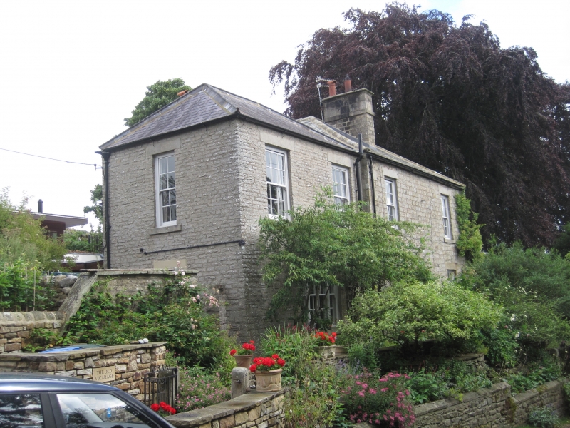
LUNEDALE B6276, Laithkirk NY 92 SE (North side) 10/116 The Old Vicarage II House, former vicarage. 1845 with c.1880 wing and early C20 additions. Dressed sandstone. Graduated slate roofs and stone chimney stacks. Main block with attached wing to left.
Main block: 2 storeys, 3x3 bays. Low plinth and flush quoins. Central 6-panel door and radial fanlight in round-arched stone surround with pilasters and raised keystone. Blank bay above door. Flanking replaced 12-pane sashes with flush lintels and projecting chamfered sills. Hipped roof. Central corniced ridge stack with mid band.
Set-back 2-storey, one-bay wing with tripartite ground-floor sash window and two replaced 12-pane sashes above. Hipped roof.
3-bay right return of main block: central elongated, vertically-sliding window flanked by later canted bay windows of stone; three replaced 12-pane sashes above.
Early C20 additions, to rear of wing, are not of special interest.
Listing NGR: NY9562224062
External links are from the relevant listing authority and, where applicable, Wikidata. Wikidata IDs may be related buildings as well as this specific building. If you want to add or update a link, you will need to do so by editing the Wikidata entry.


Other nearby listed buildings