Latitude: 51.989 / 51°59'20"N
Longitude: -0.6193 / 0°37'9"W
OS Eastings: 494904
OS Northings: 233177
OS Grid: SP949331
Mapcode National: GBR F2D.682
Mapcode Global: VHFQY.68YM
Plus Code: 9C3XX9QJ+H7
Entry Name: 16, Market Place
Listing Date: 23 January 1961
Last Amended: 16 March 1987
Grade: II
Source: Historic England
Source ID: 1321699
English Heritage Legacy ID: 38235
ID on this website: 101321699
Location: Woburn, Central Bedfordshire, MK17
County: Central Bedfordshire
Civil Parish: Woburn
Built-Up Area: Woburn
Traditional County: Bedfordshire
Lieutenancy Area (Ceremonial County): Bedfordshire
Church of England Parish: Woburn
Church of England Diocese: St.Albans
Tagged with: Building
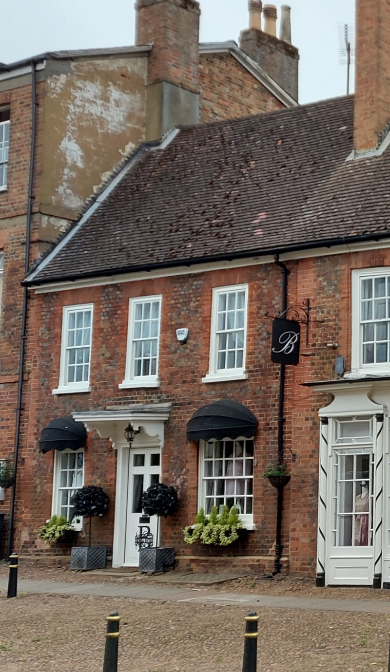
SP 9433-9533 WOBURN MARKET PLACE (West side) 8/132 23.1.61 No.16 (formerly listed as No.9 High Street) GV II House, ground floor used as shop. Earlier C18, possibly refronting an older structure. Vitrified red brick laid in header bond, with red brick dressings. C20 tile roof. 2 storeys, with 3 bay slightly irregular facade. First floor has 3 sashes with glazing bars and moulded wood frames almost flush with wall, under gauged brick flat arches. Ground floor has similar sash to LH, and later broader sash to RH. These flank doorway containing part-glazed 6-panel door. Moulded surround surmounted by flat hood on decorative cut brackets. Red brick gable end stack to LH.
Listing NGR: SP9490233185
External links are from the relevant listing authority and, where applicable, Wikidata. Wikidata IDs may be related buildings as well as this specific building. If you want to add or update a link, you will need to do so by editing the Wikidata entry.


Other nearby listed buildings