Latitude: 52.067 / 52°4'1"N
Longitude: -0.6044 / 0°36'15"W
OS Eastings: 495760
OS Northings: 241882
OS Grid: SP957418
Mapcode National: GBR F1F.B10
Mapcode Global: VHFQK.G9TR
Plus Code: 9C4X398W+R6
Entry Name: Hartwell Farmhouse
Listing Date: 23 January 1961
Grade: II
Source: Historic England
Source ID: 1321677
English Heritage Legacy ID: 38303
ID on this website: 101321677
Location: Tartlett End, Central Bedfordshire, MK43
County: Central Bedfordshire
Civil Parish: Cranfield
Built-Up Area: Cranfield
Traditional County: Bedfordshire
Lieutenancy Area (Ceremonial County): Bedfordshire
Church of England Parish: Cranfield
Church of England Diocese: St.Albans
Tagged with: Farmhouse
CRANFIELD COURT ROAD SP 9541 8/6 Hartwell Farmhouse 23.1.61 GV II
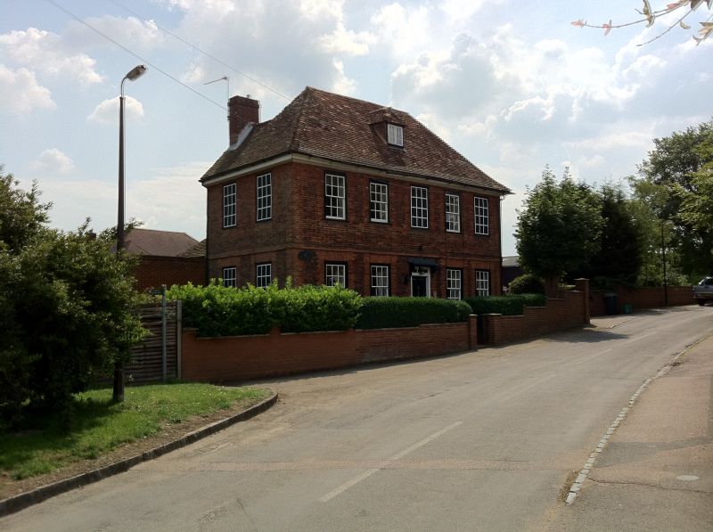
House. Earlier C18 recasing of a C17 structure. Red brick, some bricks vitrified, with lighter red brick dressings. Steep pitched hipped clay tile roof. Some substantial timber framing visible internally. Main block of 2 storeys and attics, single room deep, with lower 2-storeyed block to rear forming L-plan. Symmetrical front elevation, with brick band at first floor level. 5 windows to first floor, 4 to ground floor. Central and RH ones to first floor are blind. Others are flush sashes with glazing bars, ground floor ones under gauged brick flat arenes. Central doorway contains 6-fielded panel door under a rectangular fanlight and is surmounted by a flat hood on cut brackets. Britannia fire insurance plaque set into wall above doorway. Attic has hipped dormer containing 2-light casement. Moulded timber eaves cornice. Red brick chimney stack to rear wall. Interior: first floor hallway has some reset C17 panelling with moulded frieze.
Listing NGR: SP9576041882
External links are from the relevant listing authority and, where applicable, Wikidata. Wikidata IDs may be related buildings as well as this specific building. If you want to add or update a link, you will need to do so by editing the Wikidata entry.


Other nearby listed buildings