Latitude: 51.2177 / 51°13'3"N
Longitude: 0.4303 / 0°25'49"E
OS Eastings: 569822
OS Northings: 149310
OS Grid: TQ698493
Mapcode National: GBR NQC.MLP
Mapcode Global: VHJMK.DNTB
Plus Code: 9F326C9J+34
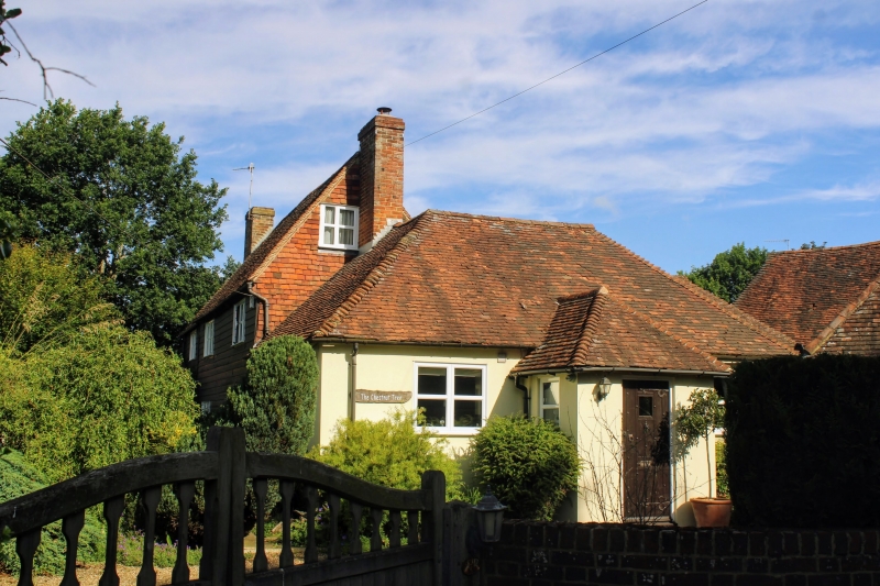
Entry Name: The Chestnut Tree
Listing Date: 14 October 1987
Grade: II
Source: Historic England
Source ID: 1320426
English Heritage Legacy ID: 174861
ID on this website: 101320426
Location: Congelow, Maidstone, Kent, ME18
County: Kent
District: Maidstone
Civil Parish: Yalding
Built-Up Area: Yalding
Traditional County: Kent
Lieutenancy Area (Ceremonial County): Kent
Church of England Parish: Yalding St Peter and St Paul
Church of England Diocese: Rochester
Tagged with: Architectural structure
YALDING BENOVER ROAD TQ 6949 (South-west side) 7/62 The Chestnut Tree GV II
House, formerly public house, now house. C18 with later additions. Timber framed, clad with blackened weatherboarding to front, tile-hung to right gable end. Plain tile roof. South facing, built at right-angles to road. 2 storeys and garret. Gabled, with projecting brick gable-end stacks. Irregular fenestration of 2 three-light wooden casements. Low single- storey addition to left gable end. Rear lean-to. Single-storey pebbledashed addition to right gable end, facing road, with hipped plain tile roof, gable end stack, two sashes, central half-glazed door, and blocked doorway towards right end. Interior not inspected. Included for group value.
Listing NGR: TQ6982149308
External links are from the relevant listing authority and, where applicable, Wikidata. Wikidata IDs may be related buildings as well as this specific building. If you want to add or update a link, you will need to do so by editing the Wikidata entry.


Other nearby listed buildings