Latitude: 53.1986 / 53°11'55"N
Longitude: -1.459 / 1°27'32"W
OS Eastings: 436235
OS Northings: 366975
OS Grid: SK362669
Mapcode National: GBR 69L.HXZ
Mapcode Global: WHDFG.KVFQ
Plus Code: 9C5W5GXR+F9
Entry Name: Wingerworth Methodist Church
Listing Date: 30 August 1995
Grade: II
Source: Historic England
Source ID: 1319828
English Heritage Legacy ID: 393553
ID on this website: 101319828
Location: North East Derbyshire, S42
County: Derbyshire
District: North East Derbyshire
Civil Parish: Wingerworth
Traditional County: Derbyshire
Lieutenancy Area (Ceremonial County): Derbyshire
Church of England Parish: Wingerworth All Saints
Church of England Diocese: Derby
Tagged with: Protestant church building
WINGERWORTH SK36NE MALTHOUSE LANE 1264-0/6/152 (West side) Wingerworth Methodist Church
II
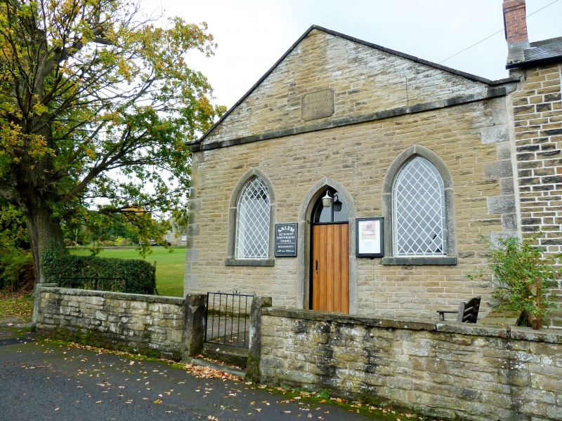
Nonconformist chapel. Dated 1849. Coursed squared Coal Measures Sandstone with ashlar dressings, quoins, coped gables with moulded kneelers, and a Welsh slate roof. North-east elevation has gable to street, with central doorway and flanking single-light window, all with steeply pointed arched heads. Doorway with ashlar surround, and plain planked door with pointed arched overlight. Windows with ashlar surrounds, and diamond-paned cast-iron frames with rectangular margin panes. Plain band course at kneeler level,and inscribed tablet to gable apex which reads 'SALEM INDEPENDENT CHAPEL 1849'. Two pointed arched windows with cast-iron frames to side elevations. Plain interior.
Listing NGR: SK3623566975
External links are from the relevant listing authority and, where applicable, Wikidata. Wikidata IDs may be related buildings as well as this specific building. If you want to add or update a link, you will need to do so by editing the Wikidata entry.


Other nearby listed buildings