Latitude: 51.4472 / 51°26'50"N
Longitude: -2.5119 / 2°30'43"W
OS Eastings: 364518
OS Northings: 172153
OS Grid: ST645721
Mapcode National: GBR CVN.N1
Mapcode Global: VH88P.DWWF
Plus Code: 9C3VCFWQ+V6
Entry Name: The Grange
Listing Date: 6 June 1951
Grade: II
Source: Historic England
Source ID: 1319747
English Heritage Legacy ID: 28723
ID on this website: 101319747
Location: Hanham, South Gloucestershire, BS15
County: South Gloucestershire
Civil Parish: Hanham
Built-Up Area: Bristol
Traditional County: Gloucestershire
Lieutenancy Area (Ceremonial County): Gloucestershire
Church of England Parish: Hanham
Church of England Diocese: Bristol
Tagged with: Building
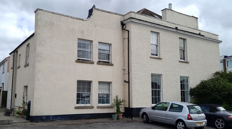
1. 5118 EX-KINGSWOOD UD HIGH STREET Hanham No 142 (The Grange) ST 6472 12/166 6.6.51. II 2. Early C19, set back from road and buried in modern housing. Rendered walling, hipped machine tile roof, tall ashlar stacks with caps, set diagonally. Symmetrical 2 storey 3 unit facade of good proportions with parapet and pediment to slightly projecting centre, windows one:one:one, glazing bar sashes, sliding louvred shutters. Central door opening, reeded doorcase, double marginally glazed doors with reeded and shaped lower panels (this pattern repeated on shutters). Portico with closed sides to full width of centre unit with flat entablature on end pilasters and 2 Roman Doric columns. Plinth course, moulded cornice, parapets with coping to side units. Pointed garden doorway (a common local feature) to right hand side.
Listing NGR: ST6451872153
External links are from the relevant listing authority and, where applicable, Wikidata. Wikidata IDs may be related buildings as well as this specific building. If you want to add or update a link, you will need to do so by editing the Wikidata entry.


Other nearby listed buildings