Latitude: 51.8463 / 51°50'46"N
Longitude: -0.9276 / 0°55'39"W
OS Eastings: 473970
OS Northings: 216957
OS Grid: SP739169
Mapcode National: GBR C12.69X
Mapcode Global: VHDTW.VVZH
Plus Code: 9C3XR3WC+GX
Entry Name: The Bell
Listing Date: 25 October 1951
Last Amended: 29 January 1985
Grade: II
Source: Historic England
Source ID: 1319277
English Heritage Legacy ID: 42264
ID on this website: 101319277
Location: Waddesdon, Buckinghamshire, HP18
County: Buckinghamshire
Civil Parish: Waddesdon
Built-Up Area: Waddesdon
Traditional County: Buckinghamshire
Lieutenancy Area (Ceremonial County): Buckinghamshire
Church of England Parish: Waddesdon with Over Winchendon and Fleet Marston
Church of England Diocese: Oxford
Tagged with: Pub Thatched pub
SP 7216 - 7316 WADDESDON HIGH STREET (north side)
10/118 The Bell (formerly listed as Bell Inn)
25.10.51
GV II
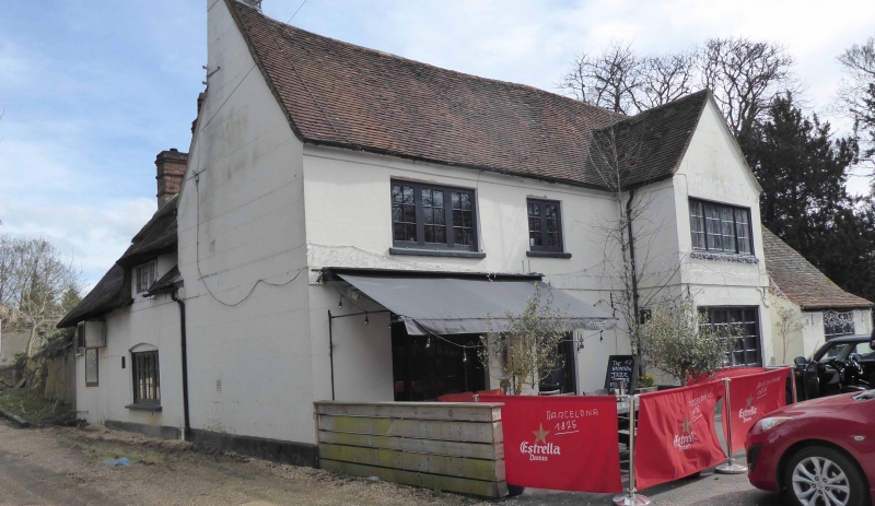
Public house. C17 and C18 altered. Right gable is of red brick with timber framing to upper part, remainder rendered and colourwashed, the front range with band courses to first floor and below eaves. Front range has C20 tiled roof with rendered and colourwashed chimney to left, lower wing to rear with thatched roof. L-plan. Front range is of 2 storeys and 3 bays, the right bay with gabled projection. Barred wooden windows: 4-light casements to right, 2-light to centre of first floor, 3-light to upper left over tripartite sash. Central C20 door with radiating semi-circular fanlight. Lower bay attached to right. C17 wing to rear is of 1½ storeys, the upper floor with an old 3-light leaded casement in thatch to right.
Listing NGR: SP7397016957
External links are from the relevant listing authority and, where applicable, Wikidata. Wikidata IDs may be related buildings as well as this specific building. If you want to add or update a link, you will need to do so by editing the Wikidata entry.


Other nearby listed buildings