Latitude: 51.1802 / 51°10'48"N
Longitude: -1.783 / 1°46'58"W
OS Eastings: 415263
OS Northings: 142349
OS Grid: SU152423
Mapcode National: GBR 4ZX.S27
Mapcode Global: VHB5C.1LRM
Plus Code: 9C3W56J8+3Q
Entry Name: Toll Cottage
Listing Date: 10 October 1988
Grade: II
Source: Historic England
Source ID: 1318489
English Heritage Legacy ID: 321348
ID on this website: 101318489
Location: Amesbury, Wiltshire, SP4
County: Wiltshire
Civil Parish: Amesbury
Built-Up Area: Countess
Traditional County: Wiltshire
Lieutenancy Area (Ceremonial County): Wiltshire
Church of England Parish: Amesbury St Mary and St Melor
Church of England Diocese: Salisbury
Tagged with: Cottage
AMESBURY COUNTESS ROAD SU 14 SE (west side)
6/37 No 43, Toll Cottage
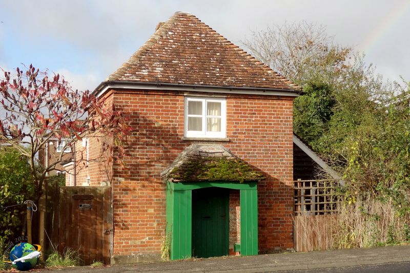
II Toll Cottage, 1762 for the Amesbury Turnpike Trust. Brick with tiled roof. Two storeys, square plan, with added lean-to to rear, and a timber weatherboarded lean-to on north side. Entrance central to elevation facing road, a boarded door within timber porch with seats either side, and tiled roof. C20 metal windows, and stone lintels. Brick dentilled eaves and pyramidal roof.
Listing NGR: SU1526342349
External links are from the relevant listing authority and, where applicable, Wikidata. Wikidata IDs may be related buildings as well as this specific building. If you want to add or update a link, you will need to do so by editing the Wikidata entry.


Other nearby listed buildings