Latitude: 54.4043 / 54°24'15"N
Longitude: -1.7355 / 1°44'7"W
OS Eastings: 417269
OS Northings: 501010
OS Grid: NZ172010
Mapcode National: GBR JKBH.2Y
Mapcode Global: WHC6D.9KTG
Plus Code: 9C6WC737+PR
Entry Name: The Grove
Listing Date: 1 August 1952
Grade: II*
Source: Historic England
Source ID: 1318419
English Heritage Legacy ID: 322960
ID on this website: 101318419
Location: Richmond, North Yorkshire, DL10
County: North Yorkshire
District: Richmondshire
Civil Parish: Richmond
Built-Up Area: Richmond
Traditional County: Yorkshire
Lieutenancy Area (Ceremonial County): North Yorkshire
Church of England Parish: Richmond with Holy Trinity with Hudswell
Church of England Diocese: Leeds
Tagged with: Architectural structure
1. FRENCHGATE 1549 (West Side) No 37 (The Grove) NZ 1701 NW 3/71 1.8.52.
II* GV
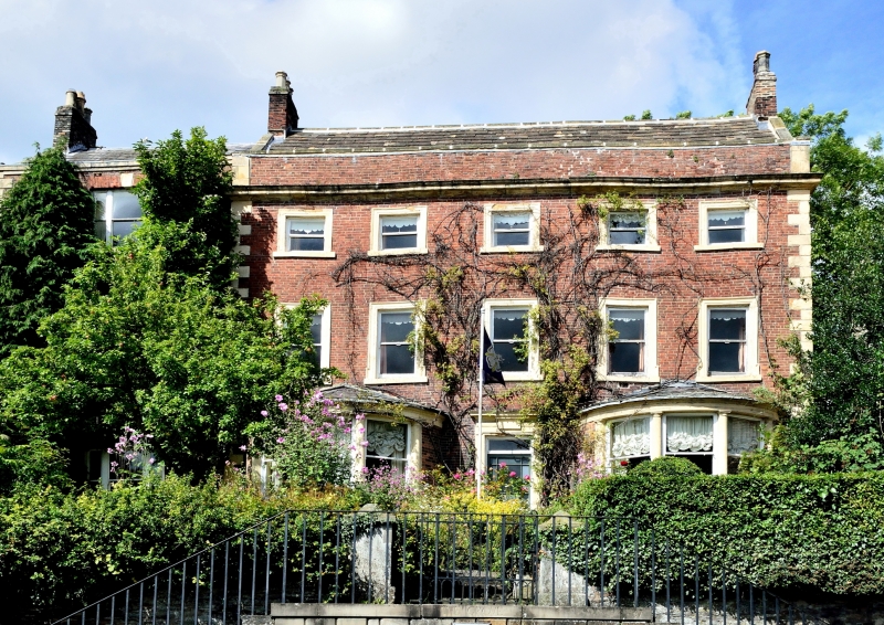
2. A large red brick mansion set back from the rood. Built in 1750 by Caleb Readshaw, Mayor of Richmond. Old slate roof. Original part of three storeys. Five windows, moulded stone frames, hung sashes, no glazing bars. A one-window extension on the left hand. Chamfered stone quoins. Moulded stone cornice. Brick parapets, stone capped. Left-hand section set back slightly. One three-light window to each storey, rusticated stone keystones, no glazing bars. Main section has two large ground-floor semi-circular bows with stone half-columnn, probably early C19. Three lights. Later central moulded stone doorcase with plain frame, pulvinated frieze and cornice. Modern door. Interior probably good. N.M.R.
Nos 1 to 27 (consec) and Nos 31 to 43 (consec) form a group.
Listing NGR: NZ1726901010
External links are from the relevant listing authority and, where applicable, Wikidata. Wikidata IDs may be related buildings as well as this specific building. If you want to add or update a link, you will need to do so by editing the Wikidata entry.


Other nearby listed buildings