Latitude: 54.4006 / 54°24'2"N
Longitude: -1.7403 / 1°44'25"W
OS Eastings: 416956
OS Northings: 500605
OS Grid: NZ169006
Mapcode National: GBR JK9K.08
Mapcode Global: WHC6D.7NJ8
Plus Code: 9C6WC725+7V
Entry Name: The Green Bridge
Listing Date: 1 August 1952
Grade: II*
Source: Historic England
Source ID: 1318388
English Heritage Legacy ID: 322892
ID on this website: 101318388
Location: Richmond, North Yorkshire, DL10
County: North Yorkshire
District: Richmondshire
Civil Parish: Richmond
Built-Up Area: Richmond
Traditional County: Yorkshire
Lieutenancy Area (Ceremonial County): North Yorkshire
Church of England Parish: Richmond with Holy Trinity with Hudswell
Church of England Diocese: Leeds
1.
1549
NZ 1600 NE
5/32
1.8.52
BRIDGE STREET
The Green Bridge
II*
GV
2.
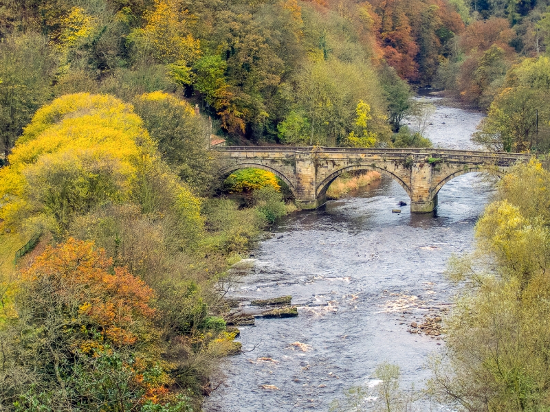
Dated 1789. Bridge in ashlar, of three moulded stone arches with rounded
bays over each pier. Plain stone parapet and capping. Architect: Carr
of York.
The Green Bridge forms a group with listed buildings in Bridge Street
Listing NGR: NZ1695600605


Other nearby listed buildings