Latitude: 53.5422 / 53°32'31"N
Longitude: -1.9938 / 1°59'37"W
OS Eastings: 400507
OS Northings: 405062
OS Grid: SE005050
Mapcode National: GBR GWJG.4Y
Mapcode Global: WHB9D.B7T9
Plus Code: 9C5WG2R4+VF
Entry Name: Pinfold Farmhouse
Listing Date: 3 July 1986
Grade: II
Source: Historic England
Source ID: 1318184
English Heritage Legacy ID: 212207
ID on this website: 101318184
Location: Bunkers, Oldham, Greater Manchester, OL3
County: Oldham
Civil Parish: Saddleworth
Traditional County: Yorkshire
Lieutenancy Area (Ceremonial County): Greater Manchester
Church of England Parish: Saddleworth St Chad
Church of England Diocese: Manchester
Tagged with: Farmhouse
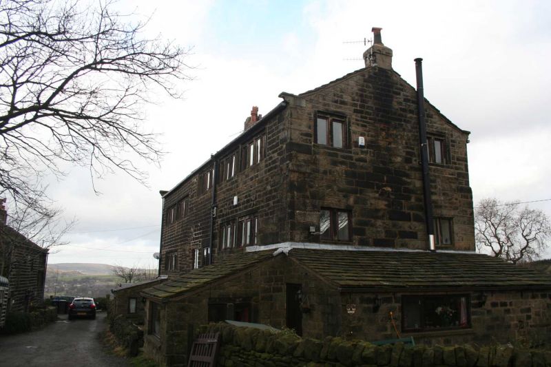
SADDLEWORTH KNOWL TOP LANE SE 00 NW (west side) 4/190 Pinfold Farmhouse - G.V. II Farmhouse. Partly early C17 but with successive extension and rebuilding of the early and late C18. Dressed stone and hammer-dressed watershot stone with graduated stone slate roof. Single-depth plan with 3 storeys and 3 bays with lean- to extensions to right gable and front right and left. Bay 3 incorporates the earliest work retaining a 4-light double- chamfered stone mullion window (2 mullions missing) and hoodmould with upturned ends. Bay 2,which is later,also retains a 2-light double-chamfered mullion window adjacent to an inserted C18 door. Bay 1, again later, was probably added in late C18 when the loom workshop was added to the top floors of bays 2 and 3. Other openings are 6, 10 and 13- light recessed flat-faced mullion windows and 2 blocked taking-in doors. 2 ridge chimney stacks, coped gables and kneelers. The rear which also shows signs of various periods of construction has 2, 3, 4, 5 and 10-light windows as above. Bulletin of the Saddleworth Historical Society, Vol.2, No.1, 1972.
Listing NGR: SE0050705062
External links are from the relevant listing authority and, where applicable, Wikidata. Wikidata IDs may be related buildings as well as this specific building. If you want to add or update a link, you will need to do so by editing the Wikidata entry.


Other nearby listed buildings