Latitude: 53.9098 / 53°54'35"N
Longitude: -2.775 / 2°46'30"W
OS Eastings: 349182
OS Northings: 446240
OS Grid: SD491462
Mapcode National: GBR 9R27.05
Mapcode Global: WH84T.BZSK
Plus Code: 9C5VW65F+WX
Entry Name: Boundary Stone
Listing Date: 9 January 1986
Grade: II
Source: Historic England
Source ID: 1318134
English Heritage Legacy ID: 185512
ID on this website: 101318134
Location: Garstang, Wyre, Lancashire, PR3
County: Lancashire
District: Wyre
Civil Parish: Garstang
Built-Up Area: Garstang
Traditional County: Lancashire
Lieutenancy Area (Ceremonial County): Lancashire
Church of England Parish: Garstang St Thomas
Church of England Diocese: Blackburn
Tagged with: Boundary marker
SD 44 NE
4/118
GARSTANG
LANCASTER ROAD
Boundary stone
II
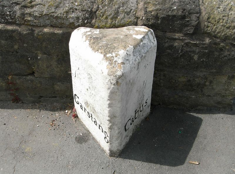
Boundary stone, C19, formerly marking boundary of Garstang and Cabus
parishes. Sandstone. Triangular plan with flat top and chamfered edges.
Left-hand face inscribed: 'Garstang'. Right-hand face inscribed: 'Cabus'.
Listing NGR: SD4918246240
External links are from the relevant listing authority and, where applicable, Wikidata. Wikidata IDs may be related buildings as well as this specific building. If you want to add or update a link, you will need to do so by editing the Wikidata entry.


Other nearby listed buildings