Latitude: 53.838 / 53°50'16"N
Longitude: -0.4232 / 0°25'23"W
OS Eastings: 503854
OS Northings: 439125
OS Grid: TA038391
Mapcode National: GBR TSH1.5X
Mapcode Global: WHGF4.GSPL
Plus Code: 9C5XRHQG+6P
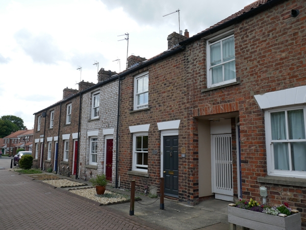
Entry Name: 42-50, St Andrews Street
Listing Date: 30 June 1987
Grade: II
Source: Historic England
Source ID: 1318064
English Heritage Legacy ID: 167423
ID on this website: 101318064
Location: Beverley, East Riding of Yorkshire, HU17
County: East Riding of Yorkshire
Civil Parish: Beverley
Built-Up Area: Beverley
Traditional County: Yorkshire
Lieutenancy Area (Ceremonial County): East Riding of Yorkshire
Church of England Parish: Beverley Minster St John and St Martin
Church of England Diocese: York
Tagged with: Building
BEVERLEY ST ANDREW'S STREET TA 0339 (west side)
10/306 Nos 42 - 50 (even)
GV II
Early C19. Brown brick. Pantiled roofs. 2 storeys. One bay each: flush framed cased sashes with glazing bars. C20 6-panel doors, fanlights with glazing bars. Moulded architraves.
Listing NGR: TA0385439125
External links are from the relevant listing authority and, where applicable, Wikidata. Wikidata IDs may be related buildings as well as this specific building. If you want to add or update a link, you will need to do so by editing the Wikidata entry.


Other nearby listed buildings