Latitude: 51.9558 / 51°57'20"N
Longitude: 0.3412 / 0°20'28"E
OS Eastings: 560975
OS Northings: 231182
OS Grid: TL609311
Mapcode National: GBR NFB.931
Mapcode Global: VHHLK.V3RH
Plus Code: 9F32X84R+8F
Entry Name: 46, Newbiggen Street
Listing Date: 20 February 1967
Grade: II
Source: Historic England
Source ID: 1317146
English Heritage Legacy ID: 122351
ID on this website: 101317146
Location: Thaxted, Uttlesford, Essex, CM6
County: Essex
District: Uttlesford
Civil Parish: Thaxted
Built-Up Area: Thaxted
Traditional County: Essex
Lieutenancy Area (Ceremonial County): Essex
Tagged with: Building
1. THAXTED NEWBIGGEN STREET (East Side) No. 46
TL 63SW: 5/87 20.2.67
GV II
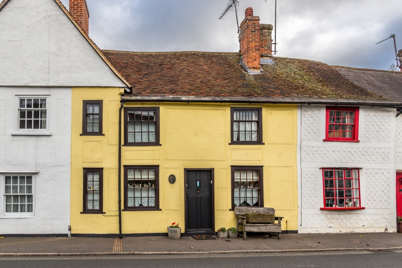
2. C17 house, timber framed and plastered with red plain tile roots. 2 storeys. 3 window range, C18 double hung vertical sliding sashes with glazing bars. Early C19 small bow window at south end. Red brick chimney stack.
Listing NGR: TL6097631181
External links are from the relevant listing authority and, where applicable, Wikidata. Wikidata IDs may be related buildings as well as this specific building. If you want to add or update a link, you will need to do so by editing the Wikidata entry.


Other nearby listed buildings