Latitude: 54.0725 / 54°4'20"N
Longitude: -2.2819 / 2°16'54"W
OS Eastings: 381652
OS Northings: 464094
OS Grid: SD816640
Mapcode National: GBR DPHB.SW
Mapcode Global: WH95D.XWKV
Plus Code: 9C6V3PC9+X7
Entry Name: Settle Bridge
Listing Date: 20 November 1987
Grade: II*
Source: Historic England
Source ID: 1317032
English Heritage Legacy ID: 323790
ID on this website: 101317032
Location: Giggleswick, North Yorkshire, BD24
County: North Yorkshire
District: Craven
Civil Parish: Giggleswick
Built-Up Area: Settle
Traditional County: Yorkshire
Lieutenancy Area (Ceremonial County): North Yorkshire
Church of England Parish: Giggleswick St Alkelda
Church of England Diocese: Leeds
GIGGLESWICK BRIDGE END SD 8064-8164 12/9 Settle Bridge
II*
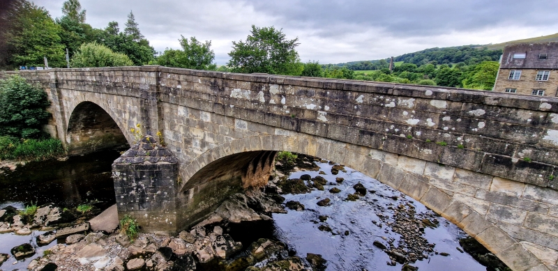
Road bridge. Probably C17, widened in second half of C18, C19 parapet walls. Squared rubble and ashlar. Two span bridge with elliptical arches and four deep ribs on upstream side of each arch, each rib chamfered at base. C18 cutwater on upstream side. Widened on downstream side with cutwater bonded into masonry. Source: Account of West Riding Bridges, 1797. West Yorkshire Record Office, Wakefield, QD 3/7. Scheduled Ancient Monument.
Listing NGR: SD8165264094


Other nearby listed buildings