Latitude: 54.2261 / 54°13'34"N
Longitude: -1.6547 / 1°39'16"W
OS Eastings: 422608
OS Northings: 481212
OS Grid: SE226812
Mapcode National: GBR JMWK.KT
Mapcode Global: WHC7D.K18H
Plus Code: 9C6W68GW+F4
Entry Name: Masham Bridge
Listing Date: 9 August 1966
Grade: II
Source: Historic England
Source ID: 1316872
English Heritage Legacy ID: 325029
ID on this website: 101316872
Location: Masham, North Yorkshire, HG4
County: North Yorkshire
District: Harrogate
Civil Parish: Masham
Built-Up Area: Masham
Traditional County: Yorkshire
Lieutenancy Area (Ceremonial County): North Yorkshire
Tagged with: Bridge Road bridge
SE 28 SW
3/39
9.8.66
MASHAM
BURTON ROAD
Masham Bridge
II
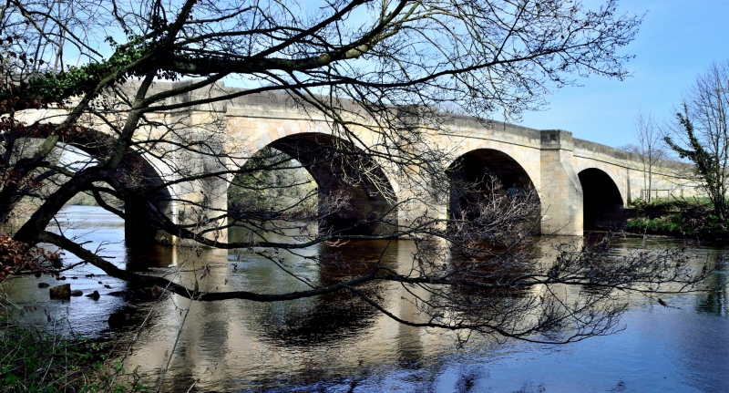
Bridge. 1754 (Pevsner). Ashlar. 4 large segmental arches with voussoirs.
Triangular-section cutwaters rise into canted pedestrian retreats. To
either side walling breaks forward. Band. Parapet. Half the bridge is in
the parish of Burton-upon-Ure.
Listing NGR: SE2260881212
External links are from the relevant listing authority and, where applicable, Wikidata. Wikidata IDs may be related buildings as well as this specific building. If you want to add or update a link, you will need to do so by editing the Wikidata entry.


Other nearby listed buildings