Latitude: 54.0706 / 54°4'14"N
Longitude: -2.0045 / 2°0'16"W
OS Eastings: 399802
OS Northings: 463854
OS Grid: SD998638
Mapcode National: GBR GPFC.TK
Mapcode Global: WHB6P.5YQ8
Plus Code: 9C6V3XCW+65
Entry Name: Grassington Bridge
Listing Date: 10 September 1954
Grade: II
Source: Historic England
Source ID: 1316846
English Heritage Legacy ID: 324787
ID on this website: 101316846
Location: Grassington, North Yorkshire, BD23
County: North Yorkshire
District: Craven
Civil Parish: Grassington
Built-Up Area: Grassington
Traditional County: Yorkshire
Lieutenancy Area (Ceremonial County): North Yorkshire
Tagged with: Bridge
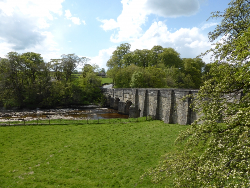
GRASSINGTON STATION ROAD SD 9863-9963 9/35 Grassington Bridge also known as Linton Bridge. 10.9.54 II Bridge over the River Wharfe. C17 origin, widened in 1780, parapet and road surface rebuilt 1824. Coursed squared gritstone and ashlar. Overall length approximately 50 metres. 4 segmental arches with recessed voussoirs and pointed cutwaters which are carried up as pilasters which interrupt the string course and projecting band at road level. Slightly ridged parapet coping. In 1598 - 1602 the bridge was ruinous and oak trees were used to repair it; after rebuilding it was repaired in 1661 and widened on the upstream side fron 10 feet to 24 feet in 1780. The downstream parapet was probably also rebuilt but the bridge had a hump-back profile until 1824/5 when it was substantially rebuilt. The later alterations were no doubt made necessary by the large numbers of pack-horses fron the lead mines which crossed the river here on the route to Skipton and Gargrave. Spans the boundary with Threshfield parish. E, Jervoise, The Ancient Bridges of the North of England, 1973, p94. S. Brooks, History of Grassington, 1979, p41.
Listing NGR: SD9980663857
External links are from the relevant listing authority and, where applicable, Wikidata. Wikidata IDs may be related buildings as well as this specific building. If you want to add or update a link, you will need to do so by editing the Wikidata entry.


Other nearby listed buildings