Latitude: 54.3829 / 54°22'58"N
Longitude: -0.7003 / 0°42'1"W
OS Eastings: 484505
OS Northings: 499384
OS Grid: SE845993
Mapcode National: GBR RKKR.5L
Mapcode Global: WHGBH.63R9
Plus Code: 9C6X97MX+5V
Entry Name: Moorgates Cattle Arch
Listing Date: 7 July 1989
Grade: II
Source: Historic England
Source ID: 1316180
English Heritage Legacy ID: 327593
ID on this website: 101316180
Location: North Yorkshire, YO22
County: North Yorkshire
District: Scarborough
Civil Parish: Goathland
Traditional County: Yorkshire
Lieutenancy Area (Ceremonial County): North Yorkshire
Church of England Parish: Goathland St Mary
Church of England Diocese: York
Tagged with: Architectural structure
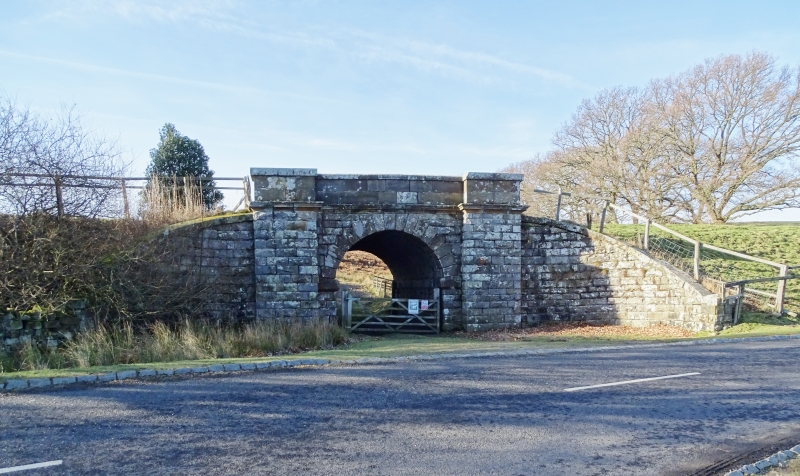
GOATHLAND MOORGATES SE 89 NW 13/117 Moorgates Cattle Arch GV II Originally railway bridge. c.1845. For the York and North Midland Railway Company. Rusticated sandstone with tooled dressings. Single semicircular arch of shaped voussoirs on chamfered imposts between pilaster buttresses. Moulded cornice beneath plain parapet with sloped coping. Buttresses rise through cornice to form terminal piers to parapet. Raked quadrant abutments with flat coping, and terminating in square piers, form retaining walls on each side. Piers have shallow pyramidal caps. Bridge was built beneath the original Whitby to Pickering railway line, to facilitate the movement of cattle without driving them across the line. Line was superseded in 1865 with the opening of the improved Deviation Line.
Listing NGR: SE8450599384
External links are from the relevant listing authority and, where applicable, Wikidata. Wikidata IDs may be related buildings as well as this specific building. If you want to add or update a link, you will need to do so by editing the Wikidata entry.


Other nearby listed buildings