Latitude: 54.5588 / 54°33'31"N
Longitude: -0.7909 / 0°47'27"W
OS Eastings: 478288
OS Northings: 518844
OS Grid: NZ782188
Mapcode National: GBR QHXQ.KL
Mapcode Global: WHF8B.TPK0
Plus Code: 9C6XH655+GJ
Entry Name: East View
Listing Date: 10 December 1985
Grade: II
Source: Historic England
Source ID: 1316105
English Heritage Legacy ID: 327186
ID on this website: 101316105
Location: Staithes, North Yorkshire, TS13
County: North Yorkshire
District: Scarborough
Civil Parish: Hinderwell
Built-Up Area: Staithes
Traditional County: Yorkshire
Lieutenancy Area (Ceremonial County): North Yorkshire
Church of England Parish: Hinderwell with Roxby and Staithes
Church of England Diocese: York
Tagged with: Building
NZ 7818 NW
8/111
HINDERWELL
HIGH STREET
(south side)
Staithes
No. 86 (East View)
II
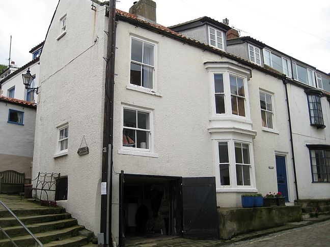
House, late C18 or early C19. Rendered, probably on stone. Pantiled roof with
rendered chimney. Two storeys, three windows, later C19 sashes, some in two-storey
canted bay. Door of 4 fielded panels under oblong fanlight. Good rear elevation
with 4 original sash windows with glazing bars and a 6-panel door.
Listing NGR: NZ7828818844
External links are from the relevant listing authority and, where applicable, Wikidata. Wikidata IDs may be related buildings as well as this specific building. If you want to add or update a link, you will need to do so by editing the Wikidata entry.


Other nearby listed buildings