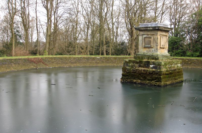
Latitude: 54.1227 / 54°7'21"N
Longitude: -0.9018 / 0°54'6"W
OS Eastings: 471873
OS Northings: 470204
OS Grid: SE718702
Mapcode National: GBR QN4R.KW
Mapcode Global: WHFBF.3MVV
Plus Code: 9C6X43FX+37
Entry Name: Castle Howard Reservoir Basin and Pedestal at Centre of Reservoir
Listing Date: 22 June 1987
Grade: II*
Source: Historic England
Source ID: 1316052
English Heritage Legacy ID: 329009
ID on this website: 101316052
Location: North Yorkshire, YO60
County: North Yorkshire
District: Ryedale
Civil Parish: Henderskelfe
Traditional County: Yorkshire
Lieutenancy Area (Ceremonial County): North Yorkshire
Church of England Parish: Bulmer St Martin
Church of England Diocese: York
Tagged with: Architectural structure
In the entry for:-
HENDERSKELFE RAY WOOD SE 7170 11/53 Castle Howard Reservoir basin and Pedestal at centre of reservoir GV II The grade shall be amended to read II* (star)
------------------------------------
HENDERSKELFE RAY WOOD SE 7170 Castle Howard 11/53 Reservoir basin and pedestal at centre of reservoir GV II Reservoir basin and pedestal in centre. 1720's. Part of a layout design for Ray Wood probably by S.Switzer. Ashlar. Circular basin approximately 30 metres in diameter with rectangular pedestal on moulded base with raised square panels and moulded cornice. Hussey C, English Gardens and Landscapes, 1967. HBMC, Register of Parks and Gardens of special historic interest in England, Part 32, North Yorkshire: Castle Howard, Grade I.
Listing NGR: SE7187470204
External links are from the relevant listing authority and, where applicable, Wikidata. Wikidata IDs may be related buildings as well as this specific building. If you want to add or update a link, you will need to do so by editing the Wikidata entry.


Other nearby listed buildings