Latitude: 51.2662 / 51°15'58"N
Longitude: 1.205 / 1°12'18"E
OS Eastings: 623683
OS Northings: 156771
OS Grid: TR236567
Mapcode National: GBR VZR.KH6
Mapcode Global: VHLGP.TFXP
Plus Code: 9F337684+F2
Entry Name: Tudor House
Listing Date: 11 October 1963
Grade: II
Source: Historic England
Source ID: 1315887
English Heritage Legacy ID: 178385
ID on this website: 101315887
Location: Wingham Green, Dover, Kent, CT3
County: Kent
District: Dover
Civil Parish: Wingham
Traditional County: Kent
Lieutenancy Area (Ceremonial County): Kent
Tagged with: House
TR 25 NW WINGHAM WATERCRESS LANE (East side)
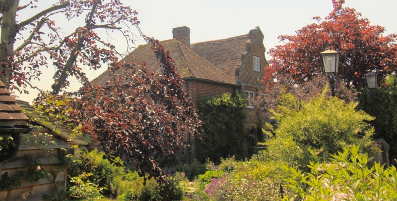
4/353 Tudor House 11.10.63 II House. C17 and C18. Red brick and plain tiled roof. Built in 2 blocks. Right hand clock 2 storeys and garret on plinth with pilaster quoins, plat band and cornice to Dutch gable with broken pediment thrusting through an open pediment, with moulded offset stack at right. Two light brick mullioned garret window, 2 leaded wooden casements on first floor and panelled door with sidelights. Half-hipped C18 block to left with right side stack and irregular fenestration of wooden casements.
Listing NGR: TR2368356771
External links are from the relevant listing authority and, where applicable, Wikidata. Wikidata IDs may be related buildings as well as this specific building. If you want to add or update a link, you will need to do so by editing the Wikidata entry.


Other nearby listed buildings