Latitude: 53.9916 / 53°59'29"N
Longitude: -1.5205 / 1°31'13"W
OS Eastings: 431538
OS Northings: 455167
OS Grid: SE315551
Mapcode National: GBR KQT8.MW
Mapcode Global: WHC8F.MX5V
Plus Code: 9C5WXFRH+JR
Entry Name: Wedderburn
Listing Date: 18 July 1949
Grade: II
Source: Historic England
Source ID: 1315843
English Heritage Legacy ID: 329954
ID on this website: 101315843
Location: High Harrogate, North Yorkshire, HG2
County: North Yorkshire
District: Harrogate
Electoral Ward/Division: Stray
Parish: Harrogate
Built-Up Area: Harrogate
Traditional County: Yorkshire
Lieutenancy Area (Ceremonial County): North Yorkshire
Church of England Parish: High Harrogate Christ Church
Church of England Diocese: Leeds
Tagged with: Building
SLINGSBY WALK 5338 Wedderburn [Nos 1 to 3 (consec)] SE 3155 SE 20/31 18.7.49. II
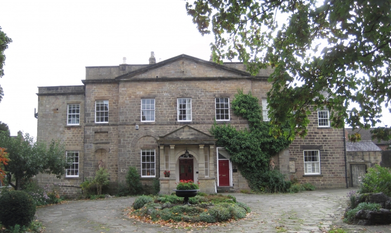
2. House. Circa 1786, possibly incorporating parts of an earlier structure Built by Lord Loughborough and attributed to Carr of York. 2 storeys. Central pedimented 3 window bay flanked by recessed one window bay with irregular one window and 2 window wings. Slated roofs. Stone ashlar with parapet. Cornice over 5 window centre and north wing. 1st floor sill band. Recessed sash windows with glazing bars; ground floor with arched recesses on each side of the central doorway and formerly over the entrance also; ground floor of flanking bays with arched niches with recessed panel over. Early C20 pedimented stone porch; doorway with patterned fanlight and panelled door. Interior altered, but with original staircase.
Listing NGR: SE3152355168
External links are from the relevant listing authority and, where applicable, Wikidata. Wikidata IDs may be related buildings as well as this specific building. If you want to add or update a link, you will need to do so by editing the Wikidata entry.


Other nearby listed buildings