Latitude: 54.2008 / 54°12'2"N
Longitude: -1.1111 / 1°6'40"W
OS Eastings: 458082
OS Northings: 478703
OS Grid: SE580787
Mapcode National: GBR NMPV.7W
Mapcode Global: WHD8S.XN2Y
Plus Code: 9C6W6V2Q+8G
Entry Name: Maynards
Listing Date: 11 December 1985
Grade: II
Source: Historic England
Source ID: 1315771
English Heritage Legacy ID: 329571
ID on this website: 101315771
Location: Ampleforth, North Yorkshire, YO62
County: North Yorkshire
District: Ryedale
Civil Parish: Ampleforth
Built-Up Area: Ampleforth
Traditional County: Yorkshire
Lieutenancy Area (Ceremonial County): North Yorkshire
Church of England Parish: Ampleforth St Hilda
Church of England Diocese: York
Tagged with: Building
This list entry was subject to a Minor Amendment on 19 January 2024 to reformat the text to current standards
SE 57 NE
5/12
AMPLEFORTH
WEST END (south side)
Maynards
GV.
II
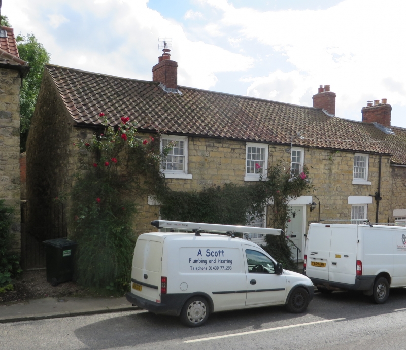
House. Early C19. Limestone rubble brought to course, pantile roof. Through-passage plan. Two storeys, four first floor windows. Four-panel door. Evidence for blocked window to right of door. Sixteen-pane sashes throughout except for eight-pane sash over door. Right end and ridge stacks. Included for group considerations.
Listing NGR: SE 58082 78703
This list entry was subject to a Minor Amendment on 19 January 2024 to reformat the text to current standards
SE 57 NE
5/12
AMPLEFORTH
WEST END (south side)
Maynards
GV.
II
House. Early C19. Limestone rubble brought to course, pantile roof. Through-passage plan. Two storeys, four first floor windows. Four-panel door. Evidence for blocked window to right of door. Sixteen-pane sashes throughout except for eight-pane sash over door. Right end and ridge stacks. Included for group considerations.
Listing NGR: SE 58082 78703
External links are from the relevant listing authority and, where applicable, Wikidata. Wikidata IDs may be related buildings as well as this specific building. If you want to add or update a link, you will need to do so by editing the Wikidata entry.


Other nearby listed buildings