Latitude: 54.1687 / 54°10'7"N
Longitude: -1.2078 / 1°12'28"W
OS Eastings: 451816
OS Northings: 475060
OS Grid: SE518750
Mapcode National: GBR NN07.9D
Mapcode Global: WHD8Y.FH21
Plus Code: 9C6W5Q9R+FV
Entry Name: The White House
Listing Date: 24 November 1988
Grade: II
Source: Historic England
Source ID: 1315207
English Heritage Legacy ID: 332763
ID on this website: 101315207
Location: Husthwaite, North Yorkshire, YO61
County: North Yorkshire
District: Hambleton
Civil Parish: Husthwaite
Built-Up Area: Husthwaite
Traditional County: Yorkshire
Lieutenancy Area (Ceremonial County): North Yorkshire
Church of England Parish: Husthwaite St Nicholas
Church of England Diocese: York
Tagged with: House
This list entry was subject to a Minor Amendment on 15 October 2025 to correct a typo in the description and to reformat the text to current standards
SE 5075-5175
11/53
HUSTHWAITE
MAIN STREET (south side)
The White House
GV
II
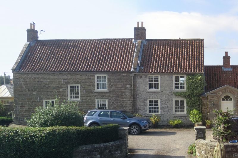
Farmhouse, now house. Mid C18, with C20 extension to left and 1987 refurbishment. Sandstone rubble, formerly whitewashed, C20 pantile roof. Two storeys and loft, three bays, with two-storey, two-bay addition to left. Main house: central part-glazed door, C20 16-pane sash windows with exposed sash boxes and flat arches. Shaped kneelers, ashlar coping. Two C20 dormer windows. Brick end stacks.
Rear: whitewashed; 16-pane sash windows in two bays flanking central staircase window. Right return: gable of brick.
Interior: on ground floor to left, inglenook fireplace with C18 cast-iron grate; C18 turned baluster closed string dogleg staircase continuing up to loft.
Listing NGR: SE5181675060
External links are from the relevant listing authority and, where applicable, Wikidata. Wikidata IDs may be related buildings as well as this specific building. If you want to add or update a link, you will need to do so by editing the Wikidata entry.


Other nearby listed buildings